Example: quiz answers
What is Spatial History? - Stanford University
Jan 10, 2002 · Figure 3 | Public Land Survey System. The Public Land Survey System (PLSS), as instituted by the Land Ordinance of 1785, organizes and divides American public lands into a rectangular system of 6-mile by 6-mile township/range squares which are further subdivided into 1-mile by 1-mile sections, numbered one through thirty-six.
Tags:
Information
Domain:
Source:
Link to this page:
Documents from same domain
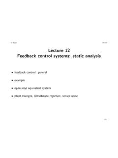
Lecture 12 Feedback control systems: static analysis
web.stanford.eduLecture 12 Feedback control systems: ... sensors: radar altimeter; ... Feedback control systems: static analysis 12{4. Example
Credit Risk Modeling with Affine Processes
web.stanford.educredit-risk modeling (emphasizing the valuation of corporate debt and credit derivatives) with an introduction to the analytical tractability and richness of affine state processes. This is not a general survey of either topic, but rather
Chemical Engineering 160/260 Important …
web.stanford.eduChemical Engineering 160/260 Important Concepts, Lecture 9-16 Lecture 9: Introduction to Thermodynamic Models for Polymer/Solvent (and Polymer/Polymer
Game Review | The Legend of Zelda
web.stanford.eduTech Specs: like nuthin' your mama has ever seen. Two chip technologies in particular are responsible for LoZ's technological prowess: MMC (Memory
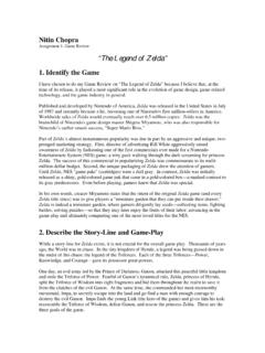
Assignment 1: Game Review “The Legend of Zelda”
web.stanford.eduNitin Chopra Assignment 1: Game Review “The Legend of Zelda” 1. Identify the Game I have chosen to do my Game Review on “The Legend of Zelda” because I …

OBIEE Upgrade from 11G Oracle Business …
web.stanford.eduOracle Business Intelligence 12c is a unique platform that enables customers to uncover new insights and make faster, ... Oracle BI Enterprise Edition ...
Introduction to Quantum Mechanics - Stanford …
web.stanford.eduIntroduction to Quantum Mechanics Gary Oas Education Program for Gifted Youth, Stanford University March 23, 2008 Introduction This two week course on quantum mechanics is meant to give a quantitative introduction to the theory and explore its
Lecture #3 Quantum Mechanics: Introduction
web.stanford.edu2 Classical versus Quantum NMR • QM is only theory that correctly predicts behavior of matter on the atomic scale, and QM effects are seen in vivo.
Reprogramming to a muscle fate by fusion …
web.stanford.eduResearch Article 1045 Introduction We have extended our earlier studies of nuclear reprogramming in heterokaryons to enhance our understanding of the mechanistic basis
Journal of Teacher Education, Vol. 51, No. 3, …
web.stanford.eduON THE NATURE OF TEACHING AND TEACHER EDUCATION ... isolation is to create a vision of learning to teach as a private ordeal (Lortie, 1975) and a vision of
Related documents

US Topo Map Symbols - EDRnet
edrnet.comFeature data is incorporated from national Geographic Information System (GIS) databases under the stewardship of USGS data programs. The US Topo map is intended for conventional map users, not for advanced GIS analysis. However, most of the data sources used are in the public domain and may be downloaded for free from The National Map