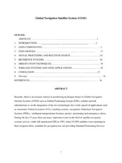
Global Navigation Satellite System (GNSS)
2.1 Global Positioning System: The United States Department of Defense (DoD) has developed the Navstar GPS, which is an all-weather, space based navigation system to meet the needs of the USA military forces and accurately determine their position, velocity, and time in a common reference system, any where
Download Global Navigation Satellite System (GNSS)

Information
Domain:
Source:
Link to this page:
Documents from same domain
Data Preparation/Descriptive Statistics
www.princeton.eduFor data analysis your data should have variables as columns and observations as rows. The first row should have the column headings. Make sure your dataset has

The Use of Integrity Tests for Pre-Employment …
www.princeton.eduThe Use of Integrity Tests for Pre-Employment Screening September 1990 OTA-SET-442 NTIS order #PB91-107011
www.princeton.edu
www.princeton.eduCreated Date: 4/18/2005 1:47:40 PM

Fundamentals in Engineering (FE) Exam
www.princeton.eduFundamentals in Engineering (FE) Exam AKA Engineer-in-Training (EIT) Exam Importance, Application, Format Prepared by Maria Garlock September 2014

Multilevel Analysis - Princeton University
www.princeton.eduPU/DSS/OTR. 2. Use multilevel model whenever your data is grouped (or nested) in more than one category (for example, states, countries, etc). Multilevel models allow:
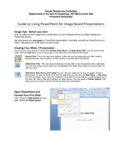
Viewing Your Slides Presentation - Princeton …
www.princeton.eduVisual Resources Collection Department of Art and Archaeology, 207 McCormick Hall Princeton University Guide to Using PowerPoint for Image Based Presentations
Monetary Policy According to HANK
www.princeton.eduVOL. 108 NO. 3 KAPLAN ET AL.: MONETARY POLICY ACCORDING TO HANK 699 within a framework that offers a better representation of household consump - tion and household finances than RANK.
Computer Architecture: A Historical Perspective
www.princeton.edu1 August 21, 2008 1 CompArch Summer School on Parallel Programming and Architectures, Brown University, Providence, RI. August 20-21, 2008 Computer Architecture:
REMOTE SENSING FROM SPACE - Princeton …
www.princeton.eduChapter 7 REMOTE SENSING FROM SPACE INTRODUCTION The value of viewing Earth from space to pro- vide crucial resource and environmental infor …

The Use of Integrity Tests for Pre-Employment …
www.princeton.eduFourth, a boost to the development and marketing of integrity tests came from the 1988 Federal ban on polygraph testing in most private establishments.
Related documents

Automatic Smart Parking System using Internet of Things …
www.ijsrp.orgvehicle. The most traffic occurs only because of vehicle ... Our system is a Raspberry pi based parking sensor which contains pi-camera to detect the empty parking spaces and sends this data to server, this stored data is accessed by users [5], [6]. This enhances the user to check the ... • Navigation system: signals the availability of ...
A Smart Anti-theft System for Vehicle Security
www.ijmmm.organti-theft using an embedded system integrated with Global Positioning System (GPS) and Global System for Mobile Communication (GSM).This proposed work is an attempt to design and develop a smart anti-theft system that uses GPS and GSM system to prevent theft and to determine the exact location of vehicle.
NAVSTAR, the Global Positioning System: A Sampling of Its ...
history.nasa.govfor several years the possibility of improved satellite-based radio navigation.three earlier space-based navigation systems or programs contributed to GpS:the Johns hopkins university Applied physics laboratory (Apl) transit, otherwise known as the naval navigation Satellite System; the naval research laboratory’s timation

Subaru SD Card Navigation System
static.nhtsa.gov1. Introduction to the Subaru SD Card Navigation System Rear view camera (if applicable) Visual guidance line Reverse On Center of vehicle 0.5m (~1.6ft) from the edge of Vehicle 1.0m (~3.3ft) 2.0m (~6.5ft) 3.0m (~9.8ft) *Bluetooth function must be enabled and phone must be paired with system. Mobile phone Navigation
ACCIDENT DETECTION AND ALERTING SYSTEM USING GPS …
www.acadpubl.euGPS - Global Positioning System GPS helps in both tracking and navigation purpose. Tracking systems is used to keep track of the vehicle without the intervention of the driver. But a navigation system guides the driver to reach the destination without any disruptions. Both tracking and navigation uses the same archite cture.

THE GLOBAL POSITIONING SYSTEM
www.civil.iitb.ac.inTHE GLOBAL POSITIONING SYSTEM AND ITS APPLICATIONS 1. INTRODUCTION The Global Positioning System (GPS) is a satellite-based navigation and surveying system for determination of precise position and time, using radio signals from the satellites, in real-time or in post-processing mode. GPS is being used all over the world for numerous navigational

Alcohol Detection System in Vehicle Using Arduino
www.irjet.netdetection system for vehicle by using alcohol sensor, GPS and GSM module. [1] In this paper author discuss about the smart helmet system using alcohol detection for vehicle protection.[3] This paper introduces methods such as alcohol detection, heart …

VEHICLE ACCIDENT DETECTION SYSTEM BY USING GSM …
www.irjet.netnavigation. Tracking systems enable a base station to keep track of the vehicles without the intervention of the driver where, as navigation system helps the driver to reach the destination. Whether navigation system or tracking system, the architecture is more or less similar. When an accident occurred in any place then GPS system tracks the
Global Navigation Satellite System (GNSS)
www.princeton.edu2.1 Global Positioning System: The United States Department of Defense (DoD) has developed the Navstar GPS, which is an all-weather, space based navigation system to meet the needs of the USA military forces and accurately determine their position, velocity, and time in a common reference system, any where

INTRODUCING SCOUT GPS LINK - Toyota
www.toyota.com1 INTRODUCING SCOUT® GPS LINK With the new Scout® GPS Link1 app, you can get cell phone-driven navigation, voice-activated search and more delivered right to your vehicle’s multimedia display. Available exclusively on model year 2016 Toyota vehicles equipped with Entune™ Audio Plus, Scout® GPS Link provides you with directions, traffic-based commute …