
Global Navigation Satellite System - UNECE
Galileo is the global navigation satellite system (GNSS) that is currently being created by the European Union (EU) and the European Space Agency (ESA).It is …
Download Global Navigation Satellite System - UNECE
Information
Domain:
Source:
Link to this page:
Documents from same domain
Evaluation of real estate property and market risk
www.unece.org© Copyright 2012, UNECE REM | 6 I. INTRODUCTION 1. The preface to the United Nations Economic Commission for Europe’s (UNECE’s) 2010 report, Policy Framework for Sustainable Real Estate Markets: Principles and
CONVENTION ON ACCESS TO INFORMATION, …
www.unece.orgThe Parties to this Convention, Recalling principle l of the Stockholm Declaration on the Human Environment, Recalling also principle 10 of …

ANNEX 4 GUIDANCE ON THE PREPARATION OF …
www.unece.org- 405 - Annex 4 GUIDANCE ON THE PREPARATION OF SAFETY DATA SHEETS (SDS) A4.1 Introduction A4.1.1 This annex provides guidance on the preparation of an SDS under the requirements of the

ANNEX 4 GUIDANCE ON THE PREPARATION OF …
www.unece.org- 377 - Annex 4 GUIDANCE ON THE PREPARATION OF . SAFETY DATA SHEETS (SDS) A4.1 Introduction A4.1.1 This annex provides guidance on the preparation of an SDS under the requirements of the
PART 1 INTRODUCTION - UNECE Homepage
www.unece.org- 4 - (b) Requirements of Canada for the workplace, consumers and pesticides; (c) European Union directives for classification and labelling of substances and
UN/LOCODE CODES FOR PORTS AND OTHER …
www.unece.orgUNITED NATIONS ECONOMIC COMMISSION FOR EUROPE UN/LOCODE CODES FOR PORTS AND OTHER LOCATIONS RECOMMENDATION No. 16 , …
PART 3 Dangerous goods list, special provisions …
www.unece.org- 283 - hazards of a mixture need to be shown, excluding controlled substances when their disclosure is prohibited by national law or international convention.
EU TYPE-APPROVAL PROCEDURE FOR VEHICLES
www.unece.org3 Article 6 Procedures to be followed for the EC type-approval of vehicles 1. The manufacturer may choose one of the following procedures: (a) step-by-step type-approval;
Agreement - UNECE
www.unece.orgGE.13- Agreement Concerning the Adoption of Uniform Technical Prescriptions for Wheeled Vehicles, Equipment and Parts which can be Fitted and/or be
ECONOMIC COMMISSION FOR EUROPE - UNECE
www.unece.orgECONOMIC COMMISSION FOR EUROPE Geneva SPATIAL PLANNING Key Instrument for Development and Effective Governance with Special Reference to Countries …
Related documents
Keysight Technologies Signal Studio for Global Navigation ...
literature.cdn.keysight.comSimplify Global Navigation Satellite System (GNSS) Signal Creation Signal Studio software is a flexible suite of signal-creation tools that will reduce the time you spend on signal simulation. For GNSS, including GPS, GLONASS, Galileo,
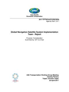
Global Navigation Satellite System Implementation Team ...
mddb.apec.orgPage 1 Final Report The 22st Meeting of the APEC GNSS Implementation Team (GIT/22) 25 – 28 April 2017, Taipei, Chinese Taipei 1. GENERAL The 22nd Meeting of the Asia Pacific Economic Cooperation (APEC) Global Navigation Satellite System (GNSS) Implementation Team (GIT/22) was hosted by Chinese Taipei from
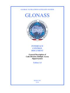
GLOBAL NAVIGATION SATELLITE SYSTEM GLONASS
russianspacesystems.ru1.1 The Global Navigation Satellite System (GLONASS) is used to provide positioning, velocity and precise time for marine, air, terrestrial, and space users, as well as to …
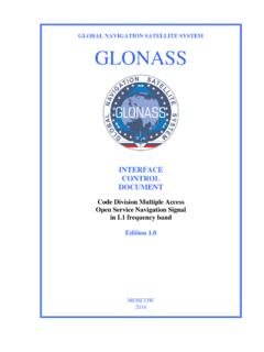
GLOBAL NAVIGATION SATELLITE SYSTEM GLONASS
russianspacesystems.ruGLONASS – Global Navigation Satellite System ICD – Interface Control Document IS – Initial State L1OC – CDMA Open Service Navigation Signal in L1 frequency band L1OCd time – time scale determined by phase of L1OCd signal at the phase center of an SV antenna
UTILIZATION OF MODERNIZED GLOBAL NAVIGATION …
web.stanford.eduAn increased number of Global Navigation Satellite System (GNSS) space vehicles, broadcasting at multiple civilian frequencies, are expected to become oper- ational over the next decade.
Global Navigation Satellite System (GNSS)
www.princeton.eduSatellite Systems (GNSS) such as Global Positioning System (GPS), cellular network infrastructure or on the integration of the two technologies for a wide spread of applications such as Automatic Vehicle Location (AVL), tracking systems, navigation, Pedestrian Navigation

Global Navigation Satellite Systems: Educational curriculum
www.unoosa.orgGlobal Navigation Satellite Systems (GNSS) include constellations of Earth-orbiting satellites that broadcast their locations in space and time, of networks of ground control stations, and of receivers that calculate ground positions by trilateration.
Current and Planned Global and Regional Navigation ...
www.unoosa.orgThe Global Navigation Satellite System 13 III. European Union The European Satellite Navigation System and the European Geostationary Navigation Overlay Service 19 IV. China The Compass/BeiDou Navigation Satellite System 35 V. Japan The Multi-functional Transport Satellite Satellite-based
Global Navigation Satellite Systems: Genesis, State of the ...
gps.mae.cornell.eduGlobal Navigation Satellite Systems: Genesis, State of the Art, and Future ... (Global Navigation Satellite Systems) in order o denote both systems without givingt precedence to either. ... The Global Positioning System (GPS) is being used in a variety of important and unusual applications. One example is the Joint Precision Approach and ...

NAVSTAR, the Global Positioning System: A Sampling of Its ...
history.nasa.govGlobal positioning System (GpS), the irst satellite navigation system that enabled users to determine precisely their location in three dimensions and time within billionths of a second, grew from a concept into a fully
Related search queries
Global Navigation, Global Navigation Satellite System, Global Navigation Satellite System Implementation Team, Global Navigation Satellite System GLONASS, Navigation, UTILIZATION OF MODERNIZED GLOBAL NAVIGATION, Global Navigation Satellite System GNSS, Satellite, Global, System, Global Navigation Satellite, Satellite navigation system, Navigation Satellite System, Satellite Satellite, Global Navigation Satellite Systems: Genesis, State, Global positioning System