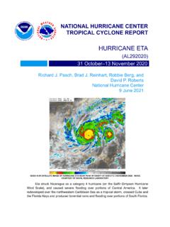
HURRICANE ETA
given in Fig. 1, with the wind and pressure histori es shown in Figs. 2 and 3, respectively. The best track positions and intensities are listed in Table 11. A ridge of high pressure to the north caused the cyclone to move westward over the west-central and western Caribbean Sea for a couple of days, and the depression strengthened into a
Download HURRICANE ETA

Information
Domain:
Source:
Link to this page:
Documents from same domain
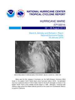
Hurricane Marie
www.nhc.noaa.govMarie was the first category 5 hurricane in the eastern North Pacific basin since Hurricane Celia in 2010. Aside from a trochoidal wobble on 24 August, Marie moved on a fairly consistent west-
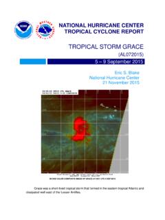
Tropical Storm Grace - National Hurricane Center
www.nhc.noaa.govGrace was a short -lived tropical storm that formed in the eastern tropical Atlantic and dissipated well east of the Lesser Antilles.
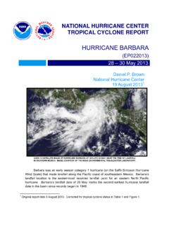
HURRICANE BARBARA
www.nhc.noaa.govhurricane barbara (ep022013) 28 – 30 may 2013 daniel p. brown national hurricane center 19 august 2013 1 goes 14 satellite image of hurricane barbara at 1815 utc 29 may, near the time of landfall in southern mexico. image courtesy of the noaa environmental visualization laboratory.
Hurricane Otis - nhc.noaa.gov
www.nhc.noaa.govOtis was a weak tropical cyclone for much of its lifetime before rapidly intensifying into a category three (on the Saffir-Simpson Hurricane Wind Scale) hurricane over the
Tropical Cyclone Report Hurricane Paula (AL182010 ...
www.nhc.noaa.govHurricane Paula (AL182010) 11 – 15 October 2010 Robbie Berg National Hurricane Center 20 December 2010 Paula was a small category 2 hurricane (on the Saffir-Simpson Hurricane Wind Scale) that formed over the western Caribbean Sea and moved northward through the Yucatan Channel.
Hurricane Genevieve - nhc.noaa.gov
www.nhc.noaa.govGenevieve was a -lived shorttropical storm that crossed °W into the central 140 Pacific as a depression. It later became a major hurricane in the central Pacific and a s uper
Tropical Cyclone Report Tropical Storm Rosa (EP172012 ...
www.nhc.noaa.govRosa was a slow-moving late-season tropical cyclone that formed well southwest of the Baja California peninsula. a. Synoptic History The passage of the Madden-Julian Oscillation (MJO) over the eastern Pacific during the last week in October likely resulted in a …
NATIONAL HURRICANE C ENTER FORECAST VERIFICATIO N …
www.nhc.noaa.govvery skillful, but were slightly outperformed by TVCE. Regarding intensity, the official forecasts have been performing better than all of the guidance during the 2014- 16 period from 12 to 48 h, but
Tropical Cyclone Report - National Hurricane Center
www.nhc.noaa.govHurricane Dean (AL042007) 13-23 August 2007 . James L. Franklin . National Hurricane Center ... passing very close to Jamaica and later making landfall on the east coast of the ... Atlantic hurricane since Andrew of 1992 to reach land at category 5 strength, was responsible for 32 deaths. a. Synoptic History . Dean originated from a well ...
Tropical Cyclone Report - National Hurricane Center
www.nhc.noaa.govIn Jamaica, the lowest observed pressure was 988.7 mb at an amateur radio station in Stoney Hill. Gustav likely caused a significant storm surge in western Cuba.
Related documents
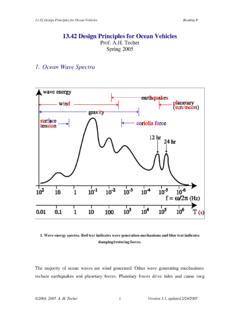
1. Ocean Wave Spectra - MIT OpenCourseWare
ocw.mit.eduFeb 24, 2005 · Wind warnings Beaufort scale Wind speed (mph) Fetch (miles) Storm duration (hr) 3-4 12 15 3 small craft 5-6 25 100 12 7 35 400 28 gale 9 50 1050 50 hurricane 70+ ©2004, 2005 A. H. Techet 3 Version 3.1, updated 2/24/2005
Section RR4402.13 HIGH VELOCITY HURRICANE ZONES …
www.broward.orgHigh-Velocity Hurricane Zone Uniform Permit Application Form. Section C (Low Slope Application) Fill in specific roof assembly components and identify manufacturer (If a component is not used, identify as “NA”) System Manufacturer: Product Approval No.: Design Wind Pressures, From RAS 128 or Calculations: Surfacing: Fastener
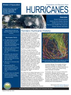
Florida’s Hurricane History
www.fdacs.govhurricane fatalities occur in water-related incidents, with 49% occurring from storm surge. Hurricane Irma is now Florida’s costliest hurricane to date, with an estimated $58 billion in economic losses. Florida’s Hurricane History. Paths of major hurricanes (Category 3 or higher) over Florida from 1851-2019.

The Florida Building Code
www.floridabuilding.orgHurricane Protection Requires additional protection from wind-borne debris in: 1. “Wind-borne debris region” where design speeds are greater than 120 mph or greater than 110 mph if within 1 mile of the coast. Except the Florida panhandle where the region lies within 1 mile of the coast. 2. “High velocity hurricane zone” of Miami-Dade

Hurricane Katrina: Why Did the Levees Fail? - Senate
www.hsgac.senate.govIII. Hurricane Katrina: Why Did the Levees Fail? A. The Levee Failures Hurricane Katrina was a catastrophic storm that made landfall in the Gulf Coast near the Louisiana and Mississippi border with wind speeds near 150 mph. But the damage in New Orleans due to the high winds and rain paled in comparison to the devastation resulting from the ...

U.S. Billion-Dollar Weather & Climate Disasters 1980-2021
www.ncdc.noaa.govSouth Dakota, North Dakota, New Mexico and Texas. There was also widespread high wind damage to homes, vehicles and businesses in many other surrounding states. Tropical Storm Elsa Tropical Cyclone $1.2B 1 Death July 2021: Tropical Storm Elsa made landfall in Taylor County, Florida producing heavy rain, wind, flooding and tornadoes in portions

Hurricane Matthew
www.nhc.noaa.govMatthew was a category 5hurricane (on the Saffir-Simpson Hurricane Wind Scale) that later made landfalls as a major hurricane along the coasts of southwestern Haiti, extreme eastern Cuba, and western Grand Bahama Island, and as a category 1 hurricane along the central coast of South Carolina. Matthew was responsible for 585direct deaths,

NO ACTIVE BRIEFING February 2, 2022 8:20 AM
www.weather.govFebruary 2, 2022 8:20 AM National Weather Service. noRR National Oceanic and Atmospheric Administration . Title: temp