HURRICANE ETA
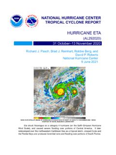
National Hurricane Center 9 June 2021 GOES-16 IR SATELLITE IMAGE OF HURRICANE ETA NEAR PEAK INTENSITY AT 0300 UTC 3 NOVEMBER 2020. IMAGE COURTESY OF NAVAL RESEARCH LABORATORY. Eta struck Nicaragua as a category 4 hurricane (on the Saffir-Simpson Hurricane Wind Scale), and caused severe flooding over portions of Central …
Download HURRICANE ETA

Information
Domain:
Source:
Link to this page:
Documents from same domain
Hurricane Marie
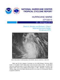
www.nhc.noaa.govMarie was the first category 5 hurricane in the eastern North Pacific basin since Hurricane Celia in 2010. Aside from a trochoidal wobble on 24 August, Marie moved on a fairly consistent west-
Tropical Storm Grace - National Hurricane Center
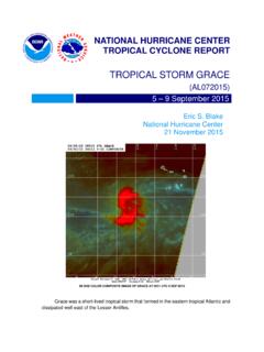
www.nhc.noaa.govGrace was a short -lived tropical storm that formed in the eastern tropical Atlantic and dissipated well east of the Lesser Antilles.
HURRICANE BARBARA
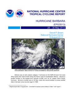
www.nhc.noaa.govhurricane barbara (ep022013) 28 – 30 may 2013 daniel p. brown national hurricane center 19 august 2013 1 goes 14 satellite image of hurricane barbara at 1815 utc 29 may, near the time of landfall in southern mexico. image courtesy of the noaa environmental visualization laboratory.
Hurricane Otis - nhc.noaa.gov
www.nhc.noaa.govOtis was a weak tropical cyclone for much of its lifetime before rapidly intensifying into a category three (on the Saffir-Simpson Hurricane Wind Scale) hurricane over the
Tropical Cyclone Report Hurricane Paula (AL182010 ...
www.nhc.noaa.govHurricane Paula (AL182010) 11 – 15 October 2010 Robbie Berg National Hurricane Center 20 December 2010 Paula was a small category 2 hurricane (on the Saffir-Simpson Hurricane Wind Scale) that formed over the western Caribbean Sea and moved northward through the Yucatan Channel.
Hurricane Genevieve - nhc.noaa.gov
www.nhc.noaa.govGenevieve was a -lived shorttropical storm that crossed °W into the central 140 Pacific as a depression. It later became a major hurricane in the central Pacific and a s uper
Tropical Cyclone Report Tropical Storm Rosa (EP172012 ...
www.nhc.noaa.govRosa was a slow-moving late-season tropical cyclone that formed well southwest of the Baja California peninsula. a. Synoptic History The passage of the Madden-Julian Oscillation (MJO) over the eastern Pacific during the last week in October likely resulted in a …
NATIONAL HURRICANE C ENTER FORECAST VERIFICATIO N …
www.nhc.noaa.govvery skillful, but were slightly outperformed by TVCE. Regarding intensity, the official forecasts have been performing better than all of the guidance during the 2014- 16 period from 12 to 48 h, but
Tropical Cyclone Report - National Hurricane Center
www.nhc.noaa.govHurricane Dean (AL042007) 13-23 August 2007 . James L. Franklin . National Hurricane Center ... passing very close to Jamaica and later making landfall on the east coast of the ... Atlantic hurricane since Andrew of 1992 to reach land at category 5 strength, was responsible for 32 deaths. a. Synoptic History . Dean originated from a well ...
Tropical Cyclone Report - National Hurricane Center
www.nhc.noaa.govIn Jamaica, the lowest observed pressure was 988.7 mb at an amateur radio station in Stoney Hill. Gustav likely caused a significant storm surge in western Cuba.
Related documents
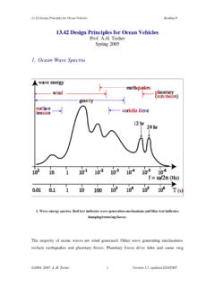
1. Ocean Wave Spectra - MIT OpenCourseWare
ocw.mit.eduFeb 24, 2005 · Wind warnings Beaufort scale Wind speed (mph) Fetch (miles) Storm duration (hr) 3-4 12 15 3 small craft 5-6 25 100 12 7 35 400 28 gale 9 50 1050 50 hurricane 70+ ©2004, 2005 A. H. Techet 3 Version 3.1, updated 2/24/2005

ProTek : Understanding Codes for Windborne Debris
www.ct.govWind Borne Debris Regions are defined as those areas within the Hurricane Prone Regions located: Within 1-mile of the coastal mean high water line where the basic wind speed is equal to or greater than 110mph and Hawaii. In areas where the basic wind speed is …

What is Storm Surge? - National Weather Service
www.weather.govThe wind circulation around the eye of a hurricane (left above) blows on the ocean surface and es a vertical produc circulation in the ocean (right above). In deep water, there is nothing to disturb this circulation and there is very little indication of storm surge. Too many exceptions to fit the scale: • Hurricane Katrina, a . category 3

Winter Storm Arrives Today February 16, 2022
www.weather.govFebruary 16, 2022 10:34 AM National Weather Service Denver, CO Winter Storm Arrives Today Key Messages General accumulations of 4 to 8 inches are

Hurricane Maria
www.nhc.noaa.govat category 5 (on the Saffir-Simpson Hurricane Wind Scale) intensity, and later devastated Puerto Rico as a high-end category 4 hurricane. It also inflicted serious damage on some of the o ther islands of the northeastern Caribbean Sea. Maria is …

Hurricane Katrina: Why Did the Levees Fail? - Senate
www.hsgac.senate.govHurricane Katrina was a catastrophic storm that made landfall in the Gulf Coast near the Louisiana and Mississippi border with wind speeds near 150 mph. But the damage in New Orleans due to the high winds and rain paled in comparison to …