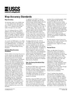
Map Accuracy Standards - USGS
point would be the intersection of two roads. Positions are established on the test points by field teams using sophis-ticated surveying techniques to determine positions from aerial photographs. Field survey methods are the only tests accepted for official accuracy testing. Positions must be obtained by surveys of a higher accuracy. Vertical ...
Download Map Accuracy Standards - USGS

Information
Domain:
Source:
Link to this page:
Documents from same domain

Status of Groundwater Levels and Storage Volume …
pubs.usgs.govvolume in the Equus Beds aquifer near Wichita, south-central Kansas, predevelopment to winter 2014 ...

Groundwater-Level and Storage-Volume Changes in …
pubs.usgs.govGroundwater-Level and Storage-Volume Changes in the Equus Beds Aquifer near Wichita, Kansas, Predevelopment through January 2015 By Joshua A. Whisnant, Cristi V. Hansen, and Patrick J. Eslick

Student Guide Tracking Change Over …
pubs.usgs.govWhat is remote sensing? Remote sensing means observing something from a distance. ... Student Guide Tracking Change Over Time—Understanding Remote Sensing

Weak-Field Magnetic Susceptibility Anisotropy and …
pubs.usgs.govWEAK-FIELD MAGNETIC SUSCEPTIBILITY ANISOTROPY AND ITS DYNAMIC MEASUREMENT By WILLIAM F. HANNA ABSTRACT The apparent magnetic susceptibility, KA, …

U.S DEPARTMENT OF THE INTERIOR U. S. …
pubs.usgs.govu.s department of the interior u. s. geological survey magnetic susceptibility measurements and sample locations of granitic rocks from along a transect of the coast mountains near

FEATURES SHOWN ON TOPOGRAPHIC MAPS - USGS
pubs.usgs.govFEATURES SHOWN ON TOPOGRAPHIC MAPS Contents Abstract ... Besides the colors used for the three main classes of features, green is used to show wood ...

Porosity and Bulk Density of Sedimentary Rocks
pubs.usgs.govPOROSITY AND BULK DENSITY OF SEDIMENTARY ROCKS ... the average and range of porosity, ... Total porosity is a measure of all the void space of porous material.

GEOLOGICAL SURVEY - USGS
pubs.usgs.govunited states geological survey charles d. walcott, director oil and gas fields of the bias coal and of the upper cretaceous and tertiary of the

Gem Stones of the United States
pubs.usgs.govGems are named for their color, type locality, outstanding physical property, or persons. The most popular gem cuts are the cabochon, rose, brilliant, step, and mixed. The carat, one-fifth of a gram or 200 milligrams, is the unit of weight measure ... PRECIOUS GEMS. GEM STONES OF THE UNITED STATES. GEM STONES OF THE UNITED STATES. GEM STONES ...

U.S. Department of the Interior U.S. Geological Survey ...
pubs.usgs.govU.S. Department of the Interior U.S. Geological Survey Natural Gemstones Searching for gemstones in the United States is a popular recreational activity for collectors and hobbyists ... Gems, when present at all, tend to be scat tered sparsely throughout a large body of
Related documents

Metals Melting Temperatures Reference Chart
appliedmc.comThis document is for reference only and should not be construed as an express or implied warranty by Vize ... Information is subject to change without notice. Metal. Melting Point (°C) (°F) Admiralty Brass: 900-940 1650-1720: Aluminum 660: 1220 Aluminum Bronze: 600-655 1190-1215: Antimony 630: 1170 Beryllium: 1285 2345: Beryllium Copper 865 ...
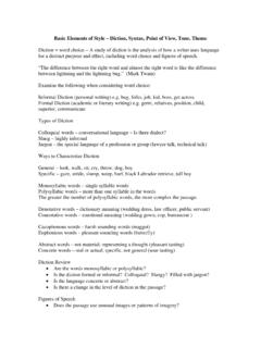
Basic Elements of Style – Diction, Syntax, Point of View ...
www.mcpshs.netOct 16, 2014 · Basic Elements of Style – Diction, Syntax, Point of View, Tone, Theme . Diction = word choice – A study of diction is the analysis of how a writer uses language for a distinct purpose and effect, including word choice and figures of speech. “The difference between the right word and almost the right word is like the difference
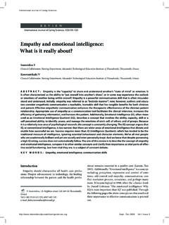
Empathy and emotional intelligence: What is it really about?
internationaljournalofcaringsciences.orgunderstand the problem through the patient’s point of view • Respect: recognition and full acceptance of the patient as a person • Authenticity: honesty, real expression of views without hypocrisy • Warmth and unconditional positive recognition • Self exposure: health care professional reports personal experiences from his perspective
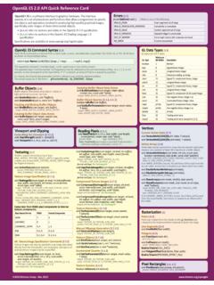
OpenGL ES 2.0 API Quick Reference Card - Khronos Group
www.khronos.orgOpenGL ES 2.0 API Quick Reference Card OpenGL® ES is a software interface to graphics hardware. The interface consists of a set of procedures and functions that allow a programmer to specify the objects and operations involved in producing high-quality graphical images, specifically color images of three-dimensional objects.