Transcription of FLOODS OF DECEMBER 1955-JANUARY 1956 IN FAR …
1 UNITED STATES DEPARTMENT OF THE INTERIOR Fred A. Seaton, SecretaryGEOLOGICAL SURVEY Thomas B. Nolan, DirectorGEOLOGICAL SURVEY CIRCULAR 380 FLOODS OF DECEMBER 1955 - january 1956 IN FAR-WESTERN STATESPEAK DISCHARGESP repared by Water Resources Division Surface Water BranchWashington, D. C,, 1956 Free on application to the Geological Survey, Washington 25, D. OF DECEMBER 1955 - january 1956 IN FAR-WESTERN STATESPEAK DISCHARGESP repared by Water Resources Division Surface Water BranchRecord-breaking FLOODS occurred in California, the western parts of Nevada, Oregon, and Idaho, and scattered basins in southern Washington during the last part of DECEMBER 1955 and in january 1956. Areas experiencing major flooding are shown on the map, page 2. Flood descriptions, by States, are briefly as follows:California. An area extending from the southern end of the Central Valley northward along the coast and inland to Nevada was flooded between DECEMBER 18 and 26, following a succession of severe rainstorms.
2 Rain extending into areas of unusually high elevation caused melting of snow in areas of low elevation. Flood volumes as well as peak discharges were high. Moderate FLOODS occurred during the period january 14-16 in the northern part of the State and about january 2,5 in the southern part. A few flood psaks exceeded those of DECEMBER , but at most places the FLOODS were not FLOODS in the Sierra Nevada region occurred about DECEMBER 23, owing to heavy rains extending into areas of high altitude. High discharges were experienced in the Carson, Truckee, and Walker River basins. january storms extended into the Humboldt and other basins, but flood peaks were not record Heavy rains and warm weather caused severe FLOODS between DECEMBER 21-23 and again on DECEMBER 26. FLOODS were most severe in southwestern Oregon, where discharges were record high, and northwestern Oregon, where discharges were of record or near-record magnitude. Other FLOODS occurred about january 4, 15, and 22, some of which were in eastern Oregon in areas which had largely escaped the FLOODS of Flooding was general in the southern and southeastern parts of the State DECEMBER 21-26 but was not record breaking although the runoff was very high.
3 Little flooding occurred during Unusual FLOODS in western-central Idaho occurred on DECEMBER 22-23 owing to havy rains which followed snow and were accompanied by unseasonably high temperatures. Highest FLOODS occurred in Payette and Weiser River basins. During january , streams in southern Idaho were at high discharges that occurred in the flood areas are presented in the following table. The Geological Survey will publish a comprehensive report of the FLOODS at a later presented in the following table is (l) a location number, for use with map on page 2; (2) name of stream and place of determination of discharge; (3) drainage area, where known; (4) period during which a systematic and continuous record of stage and discharge has been kept; (5) the maximum discharge previously recorded; and (6) for the DECEMBER 1955 - january 1956 FLOODS , the day of the peak, the peak stage, and the peak discharge and peak discharge per square discharges were determined by means of current-meter measurements, by an extension of stage-discharge rating curves, or by slope-area, contracted-opening, flow over dam, or other indirect methods.
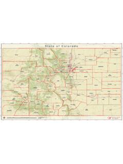
4 Indirect measure- ments, based on field surveys made after the FLOODS , were made by personnel of the Geological Survey assisted by employees of the States, the Corps of Engineers, U. S. Army, and the U. S. Bureau of tabulation of maximum discharges of the FLOODS of Dscember 1955 - january 1956 was prepared by the staff of the Surface Water Branch, Water Resources Division, U. S. Geological Survey, under the general direction of Tate Dalrymple, chief, Technical Standards Section. Most of the basic data were collected in financial cooperation with public agencies, under the direction of the following Survey district engineers: California, R C. Briggs; Nevada, M. T. Wilson; Oregon, K. N. Phillips; Washington, F. M. Veatch; and Idaho, T. R. Newell. Fieldwork and processing of data were supervised by Walter Hofmann, area staff engineer. During the FLOODS , hydraulic engineers from all sections of the country were detailed to the flooded area to assist in gathering " -45 EXPLANATIONA pproximate limit of savors floodingMap of the area of severe flooding DECEMBER 1955 - january 1956, showing general location of peak stage and discharge stages and discharges on streams in far-Western 33 4 5 67 89 1011 12 131415 16 171819 20 2122 2324 252627 28 29 30 31 32 33 34 35 36 37 3839 40 41 42 43 44 Stream and place of determinationWalker Lake BasinSwager Creek near Bridgeport, Calif Humboldt-Carson Sink BasinMarklerarUle Creek above grover Hot Springs, near Markleeville, Calif -West Fork Carson River at Woodfords, Calif Pyramid and Winnemucca Lakes Basin66 " 'Black Rock Desert BasinHoney Lake BasinWillow Creek near Susanville, Calif Earner Lakes BasinAbert Lake BasinChewaucan River above Conn ditch, near Paisley.
5 Oreg Silver Lake BasinArroyo De La Cruz BasinArroyo de la Cruz near San Simeon, Calif Carmel River BasinSalinas River BasinSalinas River above Pilitas Creek, near Santa Margarita, Calif Naclraiento River near San Miguel, Calif Pa^aro River BasinSan Benito River below MaCoy Creek near Hernandez, Calif San Benito Xiver near Willow Creek School, Calif Tres Pinos Greek near Tres Pinos, Calif Drainage area (square miles) 182 96414 34466 876b565 b940 !9463 47 249275 112 354108 250 209 Period of record1953-68 1953-56 1946-56- 1890-93; 1900-06; 1908- 10; 1917; 1924-29; 1935-37; 1939-561900-07; 1910-11; 1938- 561917-21; 1950-56 1950-56 44; 1945-55 1912-14; 1944-56 - 1915; 1922-23; 1944-56- 1922-23; 1929-56 -1912-21; 1924-56 1942-56- 1939-56 1940-56 Maximumpreviously recorded (cfs)1,400 660 6,220 2,5301,740 12,1004,730 15,5006,480 17,500 19,900940,2,590'.
6 626 1543,000660 8665,030\.000 1,80011,600 7,000e2,200S14,20053,100f6,200 8,060 Maximum DECEMBER 1955 - january 1956 DayDec. 23 Dec. 23 Dec. 23\ Dec. 23 Dec. 23 Dec. 23 Dec. 23 Dec. 23 Dec. 23 Dec. 23 Dec. 23 Jan. 15 Dec. 23 Dec. 23 Dec. 23 Dec. 23 Dec. 22 Dec. 23 Dec. 23 Dec. 22 Dec. 22 Dec. 23 Dec. 23 Dec. 23 Jan. 25 Jan. 27 Jan. 25 Jan. 25 Jan. 25 Dec. 23 Dec. 23 Dec. 24 Dec. 23 Dec. 25 Dec. 23 Dec. 23 Dec. 23 Dec. 24 Dec. 23 Dec. 23 Stage(feet) 11, 585 1,640 *765 5,180 2,450900 17,6004,810 30,000a7,010 14,400 20,8001,3803,540 712 169^,320ai,630 1,100 a4,540a3,260 a97017,700 5,2206,9304,090 6625 5,040 S12,000 1,310 30,300 58,600 14,500 625,000 3,100 27,700 S23,600S12,600 363 10,300 3,140 3,790 4,750 Cfs persq 198 166 115 341 at end of table, page 15,Maximum stages and discharges on streams in far-Western States 46474849 50 5152 53 54 55 56 5758 _59 60 61 6263 6465 66 6768 697071 72 73 74 75 7677 78 7980 81 82 8384 85 Stream and place 'of determinationPajaro River Basin ContinuedSoquel Crsek BasinSan Lorenzo River BasinScott Creek BasinPescadero Creek BasinPescadero Creek near Pescadero, Calif Purisima Creek BasinSan Francisquito Creek BasinMatadero Creek BasinStevens Creek BasinGuadalupe River BasinAlamitos Creek near Edenvale.
7 Calif Saratoga Creek at Saratoga, Calif Coyote Creek BasinC t C Mad C lifAlameda Creek Basin. icv-PSan Lorenzo Creek BasinPacheco Creek BasinKern River BasinKern River below Isabella Dam, Calif Kern River near Democrat Springs, Calif Tulare Lake BasinDrainage area ( square miles)586 1,188110 115 229149 406 1,026 5302,093 2,094 2,264 2, 261 Period of record1940-43; 1952-56 1951-56 1930-56 3 61933-56 1916-56 1911-14; 1919-42; 1947- 561945-56 Maximumpreviously recorded (cfs)5,490 11,1004,91024,000 f9,400 3,9100,440e3,650 535 2,390 2,6707,110 68,680 1,650g25,000 10,000618,500 3,440364 2,200 5,81054827,000 10,400 3,45013, 39,000 40,000 36,00014,000 25,500 MaximumDayDec. 24 Dec. 24 Dec. 23 Dec. 23 Dec. 23 Dec. 22 Dec. 23 Dec. 23 Dec. 22 Dec. 22 Dsc. 23 Dec. 23 22 Jan.
8 1 Ded. 23 Dec. 22 Dec. 22 Dec. 23 Dec. 23 Dec. 23 Dec. 22 Dec. 23 Eec. 23 Dec. 23 Dsc. 23 Dec. 23 Dsc. 23 Dec. 23 Dec. 24 Jan. 31 Dec. 29 Jan. 27 Jan. 27 Dec. 23 Dec. 23 DECEMBER 1955 - january 1956 Stage(feet) , ,460 24,000 3,82015,80030,400 30,400 8,1006,430 9,420 683 65,560 854 61,42064,140 el,320 S715 e5,740 2,730618 61,6105,810 1,880 18,200 24,800 *21,0004,7901,350 6,890 11,000 260 981 41527,200 29,400 2,0506366 el,390 e2,14012,400 24,200 Cfs per oq 134391276 264 438473 204 112 156 105 104 122 136 141 .61 .92314 footnotes at end of table, page stages and discharges on streams in far-Western States 87 8889 90 91 92 93 94 95 96 97 98 99 100 101 102 103104 105 106 107 108 109 110 111 112 113 114 115 116 117 118 119 120 121 122 123 124 125 126 127 128 129 130 131 132 133 134 135 136 137 138 139 140 141 142 143 144 145 146 147 148 Stream and place of determinationTulare Lake Basin ContinuedTule River at Worth Bridge, near Porterville, Calif Kings River below North Fork, Calif Los Gatos Creek above Hunez Canyon near Coalinga, Calif San Joaquin River BasinPitman Creek below Tamarack Creek, Calif North Fork Willow Creek near Bass Lake, Calif Little Dry Creek near Friant, Calif San Joaquin River near Biola, Calif Panoche Creek below Silver Creek near Panoche, Calif Merced River at Happy Isles Bridge near Yosemite.
9 Calif c equer,Merced River Slough near Newman, Calif South Fork Tuolumne River near Oakland Recreation Camp, Calif Tuolumne River above La Grange Dam, near La Grange, Calif Middle Fork Stanislaus River at Kennedy Meadows, Calif Middle Fork Stanislaus River at Sand Bar Flat, near Avery, Calif Drainage area (square miles)109 395 128 52032 956 174 1,350 1,542 1,542 1,694 112 . 1,042 , 1,299 130 1,480 1,633 1,675 58 1,805 299 132 270 2388, 181 47 321 912 1,020 1,035 1,2749,990 135 462 80 1, of record1953-56 1950-56 1 944-54 1921-56 1951-56 1953-56 1949-56 1 927-56 1909-56 1941-56 1952-56 1949-53 1921-23; 1930-56 1916-56 1926-56 1941-56 1901; 1909-56 - 1923-56 . 1915-56 1938-56 1905-56 Maximum discharge previously recorded (cfs)7,100 3,110 * ,000 9,150 52,00044644,000 14,000 20,300 1,400 1,000 ?
10 TB3 SJD 66,260 91,0001,250S4,320 1,530 1,760 e52,500 S2,040 3,220 . S15,100 S847 el,380 e75,000 10,300 < S77,200 1,810 62,240 3,160 8,540 10,700 22,500. 1,400 h4,4702,760 9,260 6,330 23,000 83,000 . ^ S46,200 613,600 6,410 633,000 4,900 6,660 612,900 ell,700 6,950 2,910 13,500 e61,000 657,000 61,700 4,35026,500 Maximum DECEMBER 1955 - january 1956 DayJan. 25 Dec. 23 Dec. 23 Dec. 23 Dec. ^23 Dec. 23 Itec. 23 Dec. 23 Dec. 23 Dec. 23 Dee. 23 Dec. 23 Dec. 24 Jan. 31 Jan. 31 Dec. 23 Dec. 23 Dec. 23 Dec. 23 Dec. 23 Dec. 23 Dec. 23 Dec. 23 Dec. 23 . Itec. 23 Jan. 4 Itec. 23 Dee. 23 Dec. 23 Dec. 28 Dec. 26 Dec. 24 Dec. 27- Dec. 23 Itec. 23 Dec. 23 Dec. 23 Dec. 27 Dsc. 29 Dec. '23 Dec. 23 Dec. 23 Dec. 23 Dec. 23 Dec. 23 Itec. 27 Dec. 27 Dec. 28 Dec. 28 Dec. 29 Dec. 23 Dee. 23 Dec. 22 Dec. 23 Dec. 23 Dee. 23 Dsc. 23 Dee. 24 Dec. 25 Itec. 23 Dec. 23 Dec. 23 Itec. 23(feet) 89 a 18 16,50 ,100 27,00012,500 21,500 80,700 6,070 749 59,100 11,900 85,200 10,400 6,760S248 S9,390 783 592613 1,330 S372 e63,000 645 3,670 S73,200S660 ^12,000 S92,200 7,45066,440 1,460 S7,240 1,890 13,300 17,500 30,000 545 h4,600 11,400 2,640 9,860 23,600 92,500e!