Bankhead National Forest Recreation Map
National Forest Boundary National Forest Land Private Land Populated Place Wilderness Lakes - County Boundaries Highway Other Public Roads Rivers/Streams Trais Ranger D*str.ct Office Recreation Sites Trailhead Shooting Range Horse Camp Campground A Hunt Camp Fire Tower 1/27,2016 MC DO U Corinth Recreation Area Clear Creek Recreation Area
Tags:
Information
Domain:
Source:
Link to this page:
Documents from same domain
Average Annual Cost for Road Maintenance by Operational ...
www.fs.usda.govpatching, crack sealing, chip sealing and removal of unsuitable material. Shoulders are shaped to provide a smooth transition to traveled way and drain efficiently. Ditches and culverts function efficiently. Clean/Repair structures (cattleguard, gate) and signs. Paint pavement markings. Road

CAD Standards User’s Guide - USDA
www.fs.usda.govComputer Aided Design (CAD) construction and design drawings for the Forest Service. The purpose of this document is to establish standards, which will result in the preparation of consistent and compatible AutoCAD files. It is intended to guide users in the overall CAD system, operations, and to establish standards and procedures that will
Engineering Calculations DEMOLITION DEBRIS WASTE …
www.fs.usda.govstructures. To estimate the volume of the spread footing foundation, use the surface area method. For volume estimating purposes, assume that the slab is 12 in thick. There are 15 visible courses of 8-in tall concrete masonry units (CMU) serving as the Upper Level foundation; for volume estimating purposes assume the CMU foundation
Developed Campground Rules and Regulations
www.fs.usda.govDay use visitors may be in developed recreation areas from 6 a.m. to 10 p.m. Only campers may remain in this area after 10 p.m. Check bulletin boards and observe posted hours. 36 CFR 261.58 (u). Fees Some campgrounds are designated U.S. Fee Area. You must pay a fee to use these facilities. Refer to the fee section of bulletin
Hunting Safety: Information for Hunters and Non-Hunters
www.fs.usda.govSafety Tips for Non-hunters visiting the National Forests • Wear bright clothing. Make yourself more visible. Choose colors that stand out, like red, orange or green, and avoid white, blacks, browns, earth-toned greens and animal-colored clothing. Orange vests and hats are advisable. • Don’t forget to protect fido.
HERBICIDES, TRADE NAMES, AND TARGET SPECIES
www.fs.usda.govFor any pesticide classified as a potential carcinogen, the risk would depend on the extent to which a person might be exposed (how much time and to what quantity of the pesticide). The factors considered include short-term studies, long-term cancer studies, mutagenicity studies, and structure activity concerns.
Tree Owner's Manual - USDA
www.fs.usda.govU.S. Department of Agriculture 11 Campus Blvd., Suite 200 Newtown Square, PA 19073 NA-FR-04-07 November 2008 www.na.fs.fed.us . Tree Owner's Manual . for the Northeastern and Midwestern United States . Tree Owner's Manual. Authors: Jill R. Johnson, Forest Service Gary R. Johnson, University of Minnesota Maureen H. McDonough, Michigan State ...
The Malheur National Forest - Home | US Forest Service
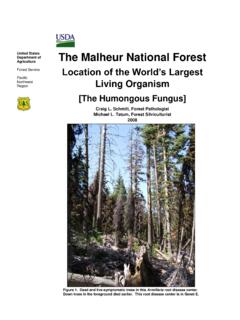
www.fs.usda.govForest Service Pacific Northwest Region The Malheur National Forest Location of the World’s Largest Living Organism [The Humongous Fungus] Craig L. Schmitt, Forest Pathologist Michael L. Tatum, Forest Silviculturist 2008 Figure 1. Dead and live-symptomatic trees in this Armillaria root disease center. Down trees in the foreground died earlier.
Snake Safety - US Forest Service
www.fs.usda.govStay calm Call Dispatch via radio or 911 Wash the bite area gently with soap and water if available Remove watches, rings, etc., which may constrict swelling
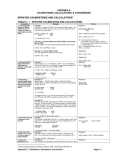
SPRAYER CALIBRATIONS AND CALCULATIONS
www.fs.usda.govV1 = 3 gallons The final mixture (Volume 2 or V2) is the amount of the concentrate (V1) plus the required amount to make up to V2. If V1 = 3 gallons and the required amount is 100 gallons, add 97 gallons of water to 3 gallons of concentrate. Formula 11 C1 x V1 = C2 x V2 C1= % of a.i. in concentrate V1 = quantity of concentrate needed
Related documents

Whiteoak Canyon Area - Shenandoah National Park US ...
www.nps.govWhiteoak boundary trailhead. • Cell and GPS services are unreliable. Good to Know Even if you are hiking from the boundary, you must have an entrance permit or annual pass. Please be prepared to self-pay (correct change or credit card) at the boundary trailhead. Backcountry camping sites are very limited in this area, so be
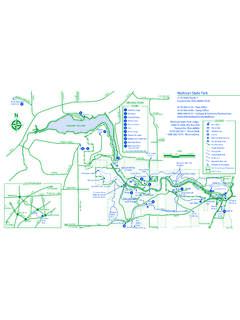
Mohican State Park - Ohio Department of Natural Resources
ohiodnr.govBike Trailhead/Parking Group Camp Area Park Boundary Forest Boundary Hiking Trail Snowmobile Trail Bridle Trail Mountain Bike Trail Wheelchair Accessible U.S. Army Corps of Engineers State Forest LOCATION MAP MANSFIELD eland I-71 BELLVILLE SR 97 BUTLER PERRYSVILLE SR 13 SR 603 SR 60 SR 39 SR 95 SR 3 Mohican State Park Rev. 4/16 0 1/4 …
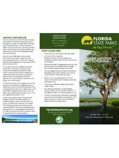
LAKE LOUISA HISTORY AND NATURE STATE PARK
www.floridastateparks.orgPark Boundary Park Road Unstabilized Hiking and Biking Trail Equestrian, Hiking and Biking Trail Dixie Lake Hammond Lake Dock EXPERIENCES AND AMENITIES Lake Louisa offers some of the most beautiful ... equestrian trailhead is located …
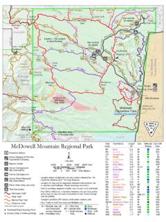
McDowell Mountain Regional Park
www.maricopacountyparks.net- Spur Trails to north boundary are Multiple Use - Lengths shown at right are one-way unless indicated by * for round-trip distance and ** for loop distance. ... Trailhead/Track Starting Point Access Gate (Limited parking) 1:60,000 500 0 500 1000 1500 Meters 2000 0 …

Usery Mountain Regional Park - Maricopa County Parks
www.maricopacountyparks.netTrailhead Access Gate Locked Gate Serv ice Road Flood Basins Park Boundary Group Picnic Area (C& D) (By reservation) Group Campground (A& B) (By reservation) VPicnic Area Buckhorn Family Campground Archery Range Nature Center Y Cholla Forest Primitive G r ou pC am (By es v t n) L engt h so wa lf r - y u indicated by * for loop distance.

Map Legend Cougar Mountain (map on reverse) Regional ...
aqua.kingcounty.govend is the Harvey Manning Trailhead, where you will ˚nd restrooms, picnic tables and a play˚eld. Jim Whittaker Wilderness Peak Trailhead From I-90˜Take Exit 15 and drive south on SR-900 (17th Avenue NW and then Renton-Issaquah Road SE) for 3.3 miles. Look for the trailhead sign and an asphalt driveway that goes uphill to the right.

Hicks Creek Loop Norwood 01/18 Hawk Loop - NC
files.nc.govTrailhead Itusi Trail– 30.5 miles. Visit trailhead for more info. Norwood Creek Loop Hawk Loop Hicks Creek Loop Monbo Loop Laurel Loop Wildlife Loop Fox Loop Loop Fox Loop W i l d l i f e R d. I n l a n d S e a Ln . S t a t e P a r k d. L o b l o l l y D r . B o a t L a u n c h D r . F a m i l y o C a m p C i r. L a k e S h or e T r il ...

Stone Mountain State Park - NC
files.nc.govLower Trailhead Parking Garden Creek Baptist Church Backpack Parking/Registration Elevation 1,354 ft. M o u n t a i n s-t o-S a S t at e T r a i l (M S T) Elevation 3,100 ft. Elevation 1,800 ft. J o h n t P . F r a n k r P a r k w a y Picnic Area Upper Trailhead Parking L o g b o t t o m R d. G r i s s e l T a i l a R d . a C e d a r R o c k T ...