Transcription of Lake Huron - Quick Links
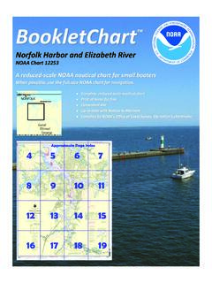
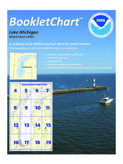
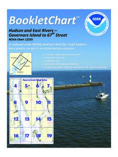
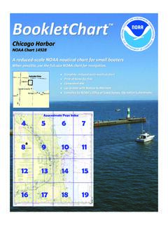
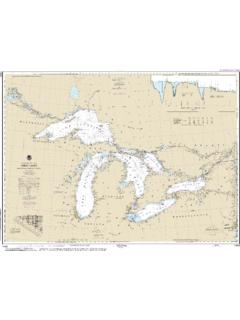
1 BookletChart lake Huron NOAA Chart 14860 A reduced-scale NOAA nautical chart for small boaters When possible, use the full-size NOAA chart for navigation. Included Area 2 Published by the National Oceanic and Atmospheric Administration National Ocean Service Office of Coast Survey 888-990-NOAA What are Nautical Charts? Nautical charts are a fundamental tool of marine navigation. They show water depths, obstructions, buoys, other aids to navigation, and much more. The information is shown in a way that promotes safe and efficient navigation.
2 Chart carriage is mandatory on the commercial ships that carry America s commerce. They are also used on every Navy and Coast Guard ship, fishing and passenger vessels, and are widely carried by recreational boaters. What is a BookletChart ? This BookletChart is made to help recreational boaters locate themselves on the water. It has been reduced in scale for convenience, but otherwise contains all the information of the full-scale nautical chart. The bar scales have also been reduced, and are accurate when used to measure distances in this BookletChart.
3 See the Note at the bottom of page 5 for the reduction in scale applied to this chart. Whenever possible, use the official, full scale NOAA nautical chart for navigation. Nautical chart sales agents are listed on the Internet at This BookletChart does NOT fulfill chart carriage requirements for regulated commercial vessels under Titles 33 and 44 of the Code of Federal Regulations. Notice to Mariners Correction Status This BookletChart has been updated for chart corrections published in the Coast Guard Local Notice to Mariners, the National Geospatial Intelligence Agency Weekly Notice to Mariners, and, where applicable, the Canadian Coast Guard Notice to Mariners.
4 Additional chart corrections have been made by NOAA in advance of their publication in a Notice to Mariners. The last Notices to Mariners applied to this chart are listed in the Note at the bottom of page 7. Coast Pilot excerpts are not being corrected. For latest Coast Pilot excerpt visit the Office of Coast Survey website at (Selected Excerpts from Coast Pilot) lake Huron is the second largest of the Great Lakes. Three large bays extend from the main body of the lake , Saginaw Bay on the W side and North Channel and Georgian Bay on the NE side.
5 The lake receives the waters of lake Michigan through the Straits of Mackinac and those of lake Superior from the St. Marys River. The lake discharges at its S end into St. Clair River at Fort Gratiot. The lake is a connecting link in the Great Lakes chain. The depth of water in St. Marys River, St. Clair River, and Detroit River governs the draft of vessels navigating lake Huron to and from Lakes Superior and Erie. Vessel Traffic Service. The Canadian Coast Guard operates a Vessel Traffic Service in Canadian waters from Long Point in lake Erie through the Detroit and St.
6 Clair Rivers to De Tour Reef Light in lake Huron . Dense fog plagues the mariner most often in spring and early summer over the open lake waters. From April into July visibilities drop below mile up to 11 percent of the time. May and June are the worst times, and the cold, central waters are the most likely place. These fogs are usually the result of warm air moving across the lake that is still cold from the previous winter season. They often come on winds with a southerly component; but NW, NE, and E winds also bring them.
7 Fog is most prevalent and thickest during the morning hours. Rain, blowing snow and low clouds also reduce visibilities, particularly from late fall through early spring. Fluctuations of water level. The normal elevation of the lake surface varies irregularly from year to year. During the course of each year, the surface is subject to a consistent seasonal rise and fall, the lowest stages prevailing during the winter and the highest during the summer. Ice. The central part of lake Huron is mainly an open water area, but drifting patches of thin ice may be present from early February until mid-March.
8 These patches drift S toward the St. Clair River. An ice bridge forms across the head of the river. Ice accumulates to a depth of 12 to 18 inches above the ice bridge; the bridge itself achieves a much greater thickness. The ice bridge is occasionally broken by high winds. Caution. A wreck covered 29 feet is west of the trackline about miles 018 from Fort Gratiot Light in about 43 'N., 82 'W. Upbound vessels from Cove Island to De Tour Passage from a position abreast of O Brien Patch Lighted Bell Buoy TC shall lay a course of 284 for miles to a position 6 miles 194 from Great Duck Island Light; then steer 300 for 48 miles to a position 3 miles 137 from De Tour Light; then steer 317 for 3 miles to a point miles 128 from De Tour Reef Light.
9 It is understood that masters may exercise discretion in departing from these courses when ice and weather conditions are such as to warrant it. The recommended courses are shown on chart 14860, lake Huron . It is recommended that the following limit of anchorage be observed in lake Huron off De Tour Light so that vessels may enter or leave De Tour Passage in time of congestion due to fog or other conditions: No vessel to anchor east of a bearing on De Tour Light of 340 , or closer than mile to the light or north of the De Tour Martin Reef course.
10 Pilotage. The waters of lake Huron in the approach to St. Clair River south of 43 05'30"N. are Great Lakes designated waters; registered vessels of the United States and foreign vessels are required to have in their service a United States or Canadian registered pilot. The remaining waters of lake Huron are Great Lakes undesignated waters; the above vessels are required to have in their service a United States or Canadian registered pilot or other officer qualified for Great Lakes undesignated waters. Registered pilots for St.