Example: stock market
Owner’s Manual - Garmin
A route is a path from your current location to one or more destinations. • The device calculates a recommended route to your destination based on the preferences you set, including the route calculation mode (Changing the Route Calculation Mode, page 4) and avoidances (Avoiding Delays, Tolls, and Areas, page 5).
Tags:
Information
Domain:
Source:
Link to this page:
Documents from same domain
EDGE® 1030 Owner’s Manual - Garmin International
static.garmin.comCharging the Device NOTICE To prevent corrosion, thoroughly dry the USB port, the weather cap, and the surrounding area before charging or connecting to
Owner’s Manual - Garmin International
static.garmin.comIntroduction WARNING See the Important Safety and Product Information guide in the product box for product warnings and other important information.
Lidar Lite v3 Operation Manual 2 and Technical …
static.garmin.com1 Lidar Lite v3 Operation Manual and Technical Specifications Laser Safety WARNING This device requires no regular maintenance. In the event that the device
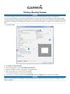
Printing a Mounting Template - Garmin
static.garmin.comPrinting a Mounting Template Notice It is not recommended that you print a mounting template on your own. Use the template that came in the product box.
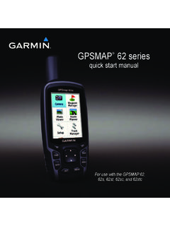
GPSMAP 62 series - Garmin
static.garmin.comGPSMAP 62 Series Quick Start Manual 3 3. Replace the battery cover. For best results, after you install new batteries, update the battery type in the

Important Safety and Product Information 2 …
static.garmin.comIMPORTANT SAFETY AND PRODUCT INFORMATION WARNING Failure to heed the following warnings could result in an accident or collision resulting in death or
Important Safety and Product Information 2 …
static.garmin.comImportant Safety and Product Information 2 Informations importantes sur le produit et la sécurité 3 guida Informazioni importanti sulla sicurezza e sul
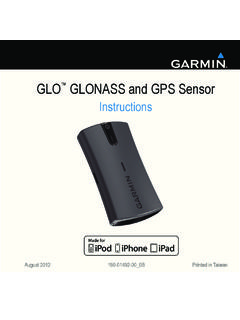
Instructions - Garmin
static.garmin.com1 GLO™ GLONASS and GPS Sensor Instructions August 2012 190-01492-00_0B Printed in Taiwan
GNS 430(A) - Garmin International
static.garmin.com190-00140-00 Rev. P GNS 430(A) Pilot’s Guide and Reference i RECORD OF REVISIONS Revision Date of Revision Description A 12/98 Initial Release B 4/99 Update to conform to recent SW changes
GNS 530(A) - Garmin International
static.garmin.com190-00181-00 Rev. H GNS 530(A) Pilot’s Guide and Reference i RECORD OF REVISIONS Revision Date of Revision Description A 5/00 Initial Release B 5/01 Update to reflect software changes through 2.06
Related documents

USER GUIDE iXpand Flash Drive - SanDisk
downloads.sandisk.com1 Connect the drive to a PC/Mac computer through the USB connector. 2 Format the drive as a regular USB flash drive. iXpand Flash Drive must be formatted as FAT-32 only. About the device 1 Go to Menu Settings About 2 Under the About section, you can see a. Current app version b. Drive firmware version c. Device ID of the drive

Iomega HDD External Hard Drive User's Manual
www.sb.fsu.eduIf you are connecting the drive to USB, also see The Iomega HDD External Hard Drive seems slow in the USB ... To obtain information about Iomega's current policies, please visit our website at www.iomega. com/support or call 1-412-690-2100 (available in the U.S. and Canada only).

DESKTOP - Seagate.com
www.seagate.comIf your computer does not have a working hard drive, or this is a new system build, go to the single drive installation instructions – page 4. • Install your new drive as additional storage in your Windows system – page 4. • Clone your old Windows boot drive to the new drive – page 5.

Services, Facilities, and Viewpoints Inside the Park
www.nps.govScenic Drive A winding scenic drive to diverse viewpoints, picnic areas, and hiking trails. Vehicles longer than 30 feet (9 m) not recommended. Allow a half- to a full-day. Point Imperial Parking, restroom, picnic area, access to Ken Patrick Trail and Point Imperial Trail. Highest point on the North Rim at 8,803 feet (2,683 m); overlooks the ...
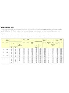
ASME/ANSI B36.10/19 - Lawrence Berkeley National Laboratory
www-eng.lbl.govASME/ANSI B36.10/19 The steel pipe data chart below can be used to find pipe sizes, diameters, wall thickness, working pressures and more. The chart is based on ASME/ANSI B 36.10 Welded and Seamless Wrought Steel Pipe