Transcription of Surveying - traverse - web - Memphis
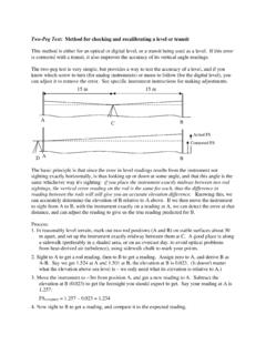
1 Surveying - traverse Almost all Surveying requires some calculations to reduce measurements into a more useful form for determining distance, earthwork volumes, land areas, etc. A traverse is developed by measuring the distance and angles between points that found the boundary of a site We will learn several different techniques to compute the area inside a traverseIntroductionSurveying - TraverseSurveying - TraverseDistance - TraverseMethods of Computing Area A simple method that is useful for rough area estimates is a graphical method In this method, the traverse is plotted to scale on graph paper, and the number of squares inside the traverse are countedADCBD istance - TraverseMethods of Computing AreaACBabc 1sin2 Area ABCac Distance - TraverseMethods of Computing AreaACBabc 1sin2 Area ABDad Dd 1sin2 Area BCDbc Area ABCDArea ABD Area BCD CIVL 1112 Surveying - traverse Calculations1/13 Distance - TraverseMethods of Computing AreaACBabc 1sin2 Area ABEae Ed 1sin2 Area CDEcd De To computeArea BCDmore data is requiredSurveying - traverse Before the areas of a piece of land can be computed, it is necessary to have a closed traverse The interior anglesof a closed traverseshould total.
2 (n - 2)(180 )where nis the number of sides of the traverseBalancing AnglesSurveying - TraverseBalancing AnglesBDACE rror of closureAngle containing mistakeSurveying - traverse A Surveying heuristic is that the total angle should not vary from the correct value by more than the square root of the number of angles measured times the precision of the instrument For example an eight-sided traverse using a 1 transit, the maximum error is:Balancing Angles1' 8 3' ' Surveying - traverse If the angles do not close by a reasonable amount, mistakes in measuring have been made If an error of 1 is made, the surveyor may correct one angle by 1 If an error of 2 is made, the surveyor may correct two angles by 1 each If an error of 3 is made in a 12 sided traverse .
3 The surveyor may correct each angle by 3 /12 or 15 Balancing AnglesENSWS urveying - traverse The closureof a traverse is checked by computing the latitudes and departures of each of it sidesLatitudes and DeparturesAENBD eparture ABLatitude ABSWCDL atitude CDDeparture CDBearing Bearing CIVL 1112 Surveying - traverse Calculations2/13 Surveying - traverse The latitudeof a line is its projection on the north south meridianLatitudes and Departures The departureof a line is its projection on the east west line A northeasterly bearing has: + latitude and + departureAENBD eparture ABLatitude ABSWB earing Surveying - traverse Consider the following statement.
4 If start at one corner of a closed traverse and walk its lines until you return to your starting point, you will have walked as far north as you walked south and as far east as you have walked west Therefore latitudes = 0 and departures = 0 Error of ClosureSurveying - traverse When latitudes are added together, the resulting error is called the error in latitudes (EL) The error resulting from adding departures together is called the error in departures (ED)Error of ClosureSurveying - traverse If the measured bearings and distances are plotted on a sheet of paper, the figure will not close because of ELand EDError of ClosureACBDELEDE rror of closure 22closureLDEEE PrecisionperimeterclosureE Typical precision: 1/5,000 for rural land, 1/7,500 for suburban land, and 1/10,000 for urban landSurveying - TraverseLatitudes and Departures - ExampleEBADCS 6 15 S 29 38 N 81 18 N 12 24 N 42 59 Surveying - TraverseENSWABL atitude ABDeparture ABLatitudes and Departures - ExampleS 6 15 W( ft.)
5 Sin(6 15 ') ( ft.)cos(6 15 ') 1112 Surveying - traverse Calculations3/13 Surveying - TraverseENSWBCL atitude BCDeparture BCLatitudes and Departures - ExampleS 29 38 E( ft.) sin(29 38 ') ( )cos(2938') - TraverseLatitudes and Departures - ExampleSideLe ngth (ft.)La titudeDeparturedegreem - TraverseLatitudes and Departures - Example 22closureLDEEE ft. PrecisionperimeterclosureE ft. 15,176 SideLe ngth (ft.)La titudeDeparturedegreem - TraverseGroup Example Problem 1 BADCS 77 10 38 43 64 09 29 16 (ft.) LatitudeDeparturedegreem - TraverseGroup Example Problem 1 Surveying - traverse Balancing the latitudes and departures of a traverse attempts to obtain more probable values for the locations of the corners of the traverse A popular method for balancing errors is called the compassor theBowditch ruleBalancing Latitudes and Departures The Bowditch rule as devised by Nathaniel Bowditch, surveyor, navigator and mathematician, as a proposed solution to the problem of compass traverse adjustment.
6 Which was posed in the American journal The Analystin 1112 Surveying - traverse Calculations4/13 Surveying - traverse The compassmethod assumes:1) angles and distances have same error2) errors are accidental The rule states: The error in latitude (departure) of a line is to the total error in latitude (departure) as the length of the line is the perimeter of the traverse Balancing Latitudes and DeparturesSurveying - TraverseEBADCS 6 15 29 38 81 18 12 24 42 59 Latitudes and DeparturesSurveying - TraverseLatitudes and Departures - ExampleSideLength (ft)LatitudeDeparturedegreem Recall the results of our example problemSurveying - TraverseLatitudes and Departures - ExampleSideLe ngth (ft)
7 La titudeDeparturedegreem Recall the results of our example problemSurveying - TraverseBalancing Latitudes and DeparturesENSWABS 6 15 in LatperimeterABLLE ABCorrection in LatperimeterLABEL ft. in ft. ft. Latitude AB( ft.)cos(6 15 ') Surveying - TraverseDeparture AB( ft.)sin(6 15 ') ABCorrection in DepperimeterABDLE ABCorrection in DepperimeterDABEL ft. in ft. ft. Balancing Latitudes and DeparturesENSWABS 6 15 1112 Surveying - traverse Calculations5/13 Surveying - TraverseBCCorrection in LatperimeterBCLLE BCCorrection in LatperimeterLBCEL ft. in ft. ft. Latitude BC( ft.)cos(29 38 ') ENSWBCS 29 38 Latitudes and DeparturesSurveying - TraverseDeparture BCBCC orrection in DepperimeterBCDLE BCCorrection in DepperimeterDBCEL ft.
8 In ft. ft. ENSWBCS 29 38 ft.( ft.) sin(29 38 ') Balancing Latitudes and DeparturesSurveying - TraverseBalancing Latitudes and DeparturesLength (ft.) Latitude DepartureLatitude DepartureLatitude ncedCorrections computed on previous slidesSurveying - TraverseBalancing Latitudes and DeparturesLength (ft.) Latitude DepartureLatitude DepartureLatitude ncedCorrected latitudes and departuresSurveying - TraverseBalancing Latitudes and DeparturesLength (ft.) Latitude DepartureLatitude DepartureLatitude ncedNo error in corrected latitudes and departuresSurveying - TraverseSideLength (ft.)
9 Latitude Departure Latitude DepartureLatitudeDeparturedegree minutesAB ringCorrectionsBalancedBalancing Latitudes and DeparturesCombining the latitude and departure calculations with corrections gives:CIVL 1112 Surveying - traverse Calculations6/13 Surveying - TraverseGroup Example Problem 2 Balance the latitudes and departures for the following (ft) Latitude Departure Latitude Departure Latitude - TraverseGroup Example Problem 3In the survey of your assign site in Project #3, you will have to balance data collected in the following 23 69 53 11 124 47 105 39 Surveying - TraverseGroup Example Problem 3In the survey of your assign site in Project #3, you will have to balance data collected in the following form:SideLength (ft.)
10 Latitude Departure Latitude DepartureLatitudeDeparturedegree m inutesAB = = Surveying - traverse The best-known procedure for calculating land areas is the double meridian distance (DMD)method The meridian distanceof a line is the east west distance from the midpoint of the line to the reference meridian The meridian distanceis positive (+) to the east and negative (-) to the westCalculating traverse AreaSurveying - TraverseCalculating traverse AreaEBADCS 6 15 29 38 81 18 12 24 42 59 - traverse The most westerly and easterly points of a traverse may be found using the departures of the traverse Begin by establishing a arbitrary reference line and using the departure values of each point in the traverse to determine the far westerly pointCalculating traverse AreaCIVL 1112 Surveying - traverse Calculations7/13 Surveying - TraverseCalculating traverse AreaLength (ft.)