Transcription of Technical Support: Projections in Nova Scotia
1 Technical Support: Projections in Nova Scotia 1 Document # : NSCRS_TS0004 Version , 15 Jan 2016 What is a projection ? Projections are used to portray the spherical Earth on a flat plane to create maps. In moving from a three dimensional shape to a two dimensional plane, distortions are introduced. Different Projections are used to preserve certain geometric relationships. What is a Transverse Mercator projection ? Transverse Mercator Projections are conformal mapping Projections which means they maintain shape. The projection mathematically translates points from an ellipsoidal surface onto an imaginary, transverse cylinder. In the case of a secant cylinder as illustrated below, two curved lines are mapped without distortion where the cylinder intersects the ellipsoid.
2 At these places of contact, the ground measurements are equal to the grid measurements, so the scale factor is one. Technical Support: Projections in Nova Scotia 2 Document # : NSCRS_TS0004 Version , 15 Jan 2016 What is the Universal Transverse Mercator (UTM) projection ? The UTM projection divides the Earth into 60 zones of 6 degrees (6 * 60 = 360 ) Zones 7-22 cover Canada. UTM Zone 20 encompasses most of Nova Scotia . 63 West is Zone 20 s central meridian. At the central meridian the scale factor is Each UTM zone is given a false easting of 500,000 m to ensure positive coordinate values. UTM Characteristics Zone Width 6 Central Meridian 63 West Scale Factor @ CM Why is UTM used? UTM is used in large scale mapping because it allows for a greater area to be encompassed by a single projection zone.
3 This allows images and large tracts of land to be related more easily. Various federal organizations like the Canada Centre for Mapping and Earth Observation (CCMEO) use UTM Projections . Technical Support: Projections in Nova Scotia 3 Document # : NSCRS_TS0004 Version , 15 Jan 2016 What is the Modified Transverse Mercator (MTM) projection ? The MTM projection has been used in Nova Scotia since the late 1970s. A MTM zone refers to the area between two lines of longitude that are separated by 3 degrees. MTM Zone 4 and MTM Zone 5 cover most of Nova Scotia . The scale factor at the central meridian is MTM Characteristics Zone Width 3 Zone 4 Central Meridian 61 30 W Zone 5 Central Meridian 64 30 W Scale Factor at Central Meridian Why is the MTM projection used?
4 The use of smaller zones reduces scale factors and the differences between ground and grid distances. This is favorable for survey work where clients expect grid distances shown on a plan to match what it measured on the ground. Why are false easting used in MTM and what are they? False easting are given to the central meridian in each zone to prevent the use of negative numbers. Additionally, false eastings can allow for quick recognition and differentiation between coordinate systems. The table below shows the MTM false eastings used to distinguish between different datum. The primary false eastings are 4,500,000 and 5,500,000 for Zones 4 and 5 respectively. Each new version of MTM coordinates has a numeric prefix added to indicate a new version number.
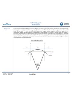
5 ATS77 can be thought of as Version 0, NAD83(CSRS) as Version 1 and NAD83(CSRS) as Version 2. Datum Zone 4 False Easting Zone 5 False Easting ATS77 4,500,000 5,500,000 NAD83 (CSRS) 14,500,000 15,500,000 NAD83 (CSRS) 24,500,000 25,500,000 Technical Support: Projections in Nova Scotia 4 Document # : NSCRS_TS0004 Version , 15 Jan 2016 Related Technical Support Documents: - NSCRS Technical Support 0006 Scale Factors Useful Links: Datums, Coordinate Systems and Map Projections (GPS) Part 2 Illustrations: MTM projection in Nova Scotia Technical Support: Projections in Nova Scotia 5 Document # : NSCRS_TS0004 Version , 15 Jan 2016 UTM projection in Nova Scotia