Transcription of Zoning 101 - Dallas
1 Zoning 101 December 22, 2020 December 23, 2020 January 4, 2021 January 5, 2021 Current Planning DivisionSustainable Development and ConstructionWhat Is Zoning ? Zoning is the way municipalities can manage: the use to which individual property may be put the physical development of land how and what can be built Zoning laws typically specify the areas in specific types or categories of uses may take place. For instance: Residential Retail Commercial Industrial Zoning laws can also regulate: Dimensional requirements for lots and buildings density Intensity of development2 What Does Zoning Accomplish? Compatibility Separates land uses that are not compatible with each other Best Use of Property Location Adjacent and surrounding land uses Predictability Guide for orderly development Health, safety, and welfare Compatibility of uses Size and Scale of buildings Open Space/Green Space Noise Light3 Types of Zoning In DallasZoning divides the city into zones for different purposes.
2 The regulations restrict the physical development and use of specific parcels of land. Base Zoning categories GeneralZoning/StraightZoning (A);CR,IM,MU-2,CA-1(A) PlannedDevelopmentDistricts , , ConservationDistricts Forexample:MStreets,BishopArts FormDistricts Forexample:WMU-20,RTN,WR-5 Overlays SpecificUsePermit(SUP) Forexample:child-carefacility,school,bar ,concretebatchplant Historic Forexample:SwissAvenue,JuniusHeights NeighborhoodStabilizationOverlay Forexample:LaBajada,CedarOaks AccessoryDwellingUnitOverlay:-Forexample :singlefamilyuses4 Types of Base Zoning General Zoning /Straight Zoning Residential Districts Non-Residential Districts Planned Development Districts Tailors the uses and development regulations for an area Conservation Districts Conserves an area s distinctive character by protecting or enhancing its physical attributes and architecture Form Districts Create walkable, mixed use developments based on scale and building type, and street front design standards5 Types of Zoning Overlays Specific Use Permits (SUP)
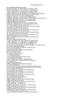
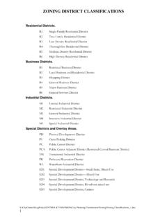
3 Provides a means for developing certain uses in a manner in which the specific use will be compatible with adjacent property and consistent with the character of the neighborhood. Historic Districts Protects and preserves historic architecture and character Neighborhood Stabilization Overlay Preserves single family neighborhoods by imposing neighborhood-specific yard, lot, and space regulations that reflect the existing character of the neighborhood Accessory Dwelling Unit Overlay May only be placed on an area that allows single family uses and does not expressly prohibit accessory dwelling of Base Zoning7 Base Zoning DistrictsResidential Agricultural:A(A) SingleFamily:R-1ac(A),R-1/2ac(A),R-15(A) ,R-13(A),R-10(A) (A),R-5(A) Duplex:D Townhouse:TH-1(A),TH-2(A),TH-3(A) ClusteredHousing:CH Multifamily:MF-1,MF-2,MF-3,MF-4 MobileHome.
4 MH(A)8 DuplexSingle-FamilyTownhouseMobile HomeAgriculturalMultifamilyMultifamilyBa se Zoning DistrictsNon-residential Office:NO(A),LO(A),MO(A),GO(A) Exampleofuses:offices,banks,medicalclini c,church,school Retail:NS(A),CR,RR Exampleofuses:retailstores(smalltobigbox dependingonthedistrict),personalserviceu ses,office,restaurants,church,school CommercialServiceandIndustrial:CS,LI,IR, IM Exampleofuses:Machineorweldingshop,autor epair,hospital,hotel,office,bigretail,re staurant,personalserviceuses,warehouse,m oreintenseindustrialuses CentralArea:CA(A)CentralArea(1and2) MixedUse:MU-1toMU-3 Exampleofuses:office,retail,personalserv ice,residential MultipleCommercial:MC-1toMC-4-Exampleofu ses:lodging,office,retail UrbanCorridor:UC-1toUC-3 ,multifamily,retail,personalserviceuses Parking.
5 P(A) -Only allows surface parking9 OfficeRetailIndustrialPlanned Development Districts (PDs) Over1,000 PlannedDevelopmentDistrictsintheCity-asl argeas3,356acresandassmallasonelot Zoningtailoredtothatspecificarea Usesanddevelopmentregulations PDsrangefrommixedusestoschoolstoresident ialtoindustrial Bestforareasthatarenew10 Conservation Districts Intendedtoprovideameansofconservinganeig hborhood sdistinctivecharacterbyprotectingorenhan cingitsphysicalandarchitecturalattribute s CDspromotedevelopmentorredevelopmentthat iscompatiblewiththeexistingareaorneighbo rhood Duringtheneighborhood-drivenprocess,each neighborhooddecideswhatisimportanttoprot ect11 Development Regulations in Base Zoning Districts12 Types of Development RegulationsZoningdistrictsestablishrules fordevelopment.
6 Includingbutnotlimitedto: Setbacks Frontyard,Sideyard,rearyard Urbanform Towerspacing Height Heightofstructures Residentialproximityslope Lotcoverage density Floorarearatio13 SetbacksFront yard setbackSide yard setbackRear yard setback Distance (in feet) from the property lines inward where no structure may be Urban Form15 Additional setback required for the portion of a structure that exceeds 45 feet in height, 10 to 20 feet, depending on the Tower Spacing16 An additional side and rear yard setback of one foot for each two feet in height above 45 feet is required for that portion of a structure above 45 feet in height, up to a total setback of 30 The vertical distance measured from grade to.
7 The midpoint of the vertical dimension between the lowest eaves and the highest ridge of the structure (gable, hip, or gambrel roofs) The midpoint of the vertical dimension of the dome (dome roofs) The highest point of the structure (any other structure)17 Height Residential Proximity Slope (RPS)181920 Lot Coverage Size of the footprint(s) of a building(s) and/or structure(s). Thelot coverageis used in calculating the intensity of use of a parcel. Example -45% lot coverage: Lot is 7,500 sq. ft., then a 1 story structure can be no larger than 7,500 x .45 = 3,375 sq. Ratio of dwelling units to lot area, typically expressed in number of units per acre22 density Insert Picture 23 Low DensityHigh DensityPicture of a 2-4 story apartment complexMedium DensityFloor Area Ratio (FAR) Floor area ratio(FAR) is the measurement of a building'sfloor areain relation to the size of the lot/parcel that the building is located on.
8 Typically, FAR is calculated by dividing the grossfloor areaof a building(s) by the total buildableareaof the piece oflandupon which it is assuming: FAR 20 Gross lot area = 10,000 square feet Lot coverage -100% Height -unlimited 10,000 sf (lot area) X 20 (FAR) = 200,000 sq. ft allowable square footage. Largest floor plate at each level is 10,000 sq. ft and can be 20 levels Assuming 15 feet height at each level, total height of the building would be 300 feetFloor Area Ratio (FAR)Mixed Income Housing Development Bonus On March 27, 2019, Council approved a by-right mixed income housing development bonus (MIHDB) in Chapter 51 and Chapter 51A. Mixed income housing development bonuses are voluntary.
9 If a developer does not want to take advantage of the bonus, he or she can Utilize the existing Zoning without the bonus, or Apply for a Zoning Income Housing Development Bonus These are the districts that Bonuses can be obtained or used: By right in MF-1(A), MF-2(A), MF-3(A), MU-1, MU-2, MU-3 districts By right in MF-1, MF-2, and MF-3 (Chapter 51) Base and bonus are determined by district regulations The development bonuses are based on height, FAR, lot coverage and parking, depending on the Zoning district27 Form Districts A Type of Base Zoning 28 Form Districts Seeks to create walkable urban neighborhoods where higher density mixed uses and mixed housing-types promote less dependence on the automobile.
10 29 Form Districts The Walkable Urban Mixed Use (WMU) districts are intended to accommodate a mix of compatible uses in close proximity to one another in a pedestrian-friendly environment. The Walkable Urban Residential (WR) districts are intended to create residential neighborhoods with mixed housing options in a pedestrian-friendly environment. The Residential Transition (RTN) district provides single-family and duplex living intended to serve as a land use transition between the more intense WMU or WR districts and established single-family of Form Districts Walkability Mixed Use Open Space Parking Space Reductions possible Landscape Buffers31 Types of Overlays32 Specific Use Permit (SUP)