
SESSION FOUR: MAPWORK CALCULATIONS KEY CONCEPTS: …
the Orthophoto map used by the learners in South Africa is 1:10 000 which means 1 CM on the map represents 0,1km on the actual ground. Maps are always smaller than the area of the ground they represent. The size, by which actual distances on the ground have been shrunk to draw proportionate maps, is known as the scale of the map.
Download SESSION FOUR: MAPWORK CALCULATIONS KEY CONCEPTS: …

Information
Domain:
Source:
Link to this page:
Documents from same domain
Algebra: Expressions, Equations and Inequalities
learn.mindset.africaC {-1, 6] D {-6, 1} Question 3 Solve the quadratic equation xx2 4 1 0. A r45 B r23 C 46 2 r D 1 and -1 Question 4 Which statement best explains why there is no real solution to the quadratic equation = A The value of 12 – 4•2•7 is positive. B The value of 12 – 4•2•7 is equal to 0.
A Guide to Euclidean Geometry - Mindset Learn
learn.mindset.africaThe Basics of Euclidean Geometry 1. What is Euclidean Geometry? This lesson introduces the concept of Euclidean geometry and how it is used in the real world today. This lesson also traces the history of geometry. 2. Revising Lines and Angles This lesson is a revision of definitions covered in previous grades. These include line
SESSION TWO: MID-LATITUDE AND TROPICAL CYCLONES …
learn.mindset.africaLimpopo, Mpumalanga, Gauteng and the northern parts of KwaZulu-Natal. 2.1 Why is it important for the South African Weather Service to issue these weather warnings? (2 x 2) (4) 2.2 Describe the environmental impact this mid-latitude cyclone might have in …
LESSON PLAN: Place Value - Mindset Learn
learn.mindset.africaPlace value: The value of a number Flash card: Cards used to work with Place Value. Teaching Method Introduce the vocabulary Hundreds, Tens and Units • Begin with showing a number and asking learners what the number is. • The learner reads out the number. Ask the learner how many digits the number has.

A Guide to Trigonometry for Beginners - Mindset Learn
learn.mindset.africaA Guide to Trigonometry for Beginners Teaching Approach When teaching trigonometry, start with a recap the theorem of Pythagoras followed by
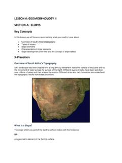
LESSON 6: GEOMORPHOLOGY II SECTION A: SLOPES
learn.mindset.africaAssumed that slopes had two facets- a gently concave lower slope or pediment and a steeper upper slope (scarp). Weathering caused the parallel retreat of the scarp slope allowing the pediment to extend in size X-ample Questions Question 1 Refer to the FIGURE showing elements of a slope to answer the questions. a.)
LESSON 3: AFRICA’S CLIMATE REGIONS
learn.mindset.africaThe sub-tropical High Pressure Belt also migrates with the seasonal movement of the overhead sun. ... Isobars that determine wind direction and wind speeds, subsidence and uplift Station models that measure present weather conditions Lines of latitude and longitude to show the position of weather phenomena
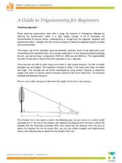
A Guide to Trigonometry for Beginners - Mindset Learn
learn.mindset.africa2: tan 8: tan 20 2 20 2 20 8 8 5 In ABC x In ADE x x xm Other uses of trigonometry and similar triangles must be highlighted to ensure learners see
LESSON 14: TOPOGRAPHIC MAPS Key Concepts
learn.mindset.africaKey Concepts In this lesson we will focus on summarising what you need to know about: Locating exact position (degrees, minutes and seconds) Relative position, direction and magnetic bearing Scale: word, ratio and line scale Distance: Measuring distances and converting to ground distance along a straight line
A Guide to Number Patterns, Sequences and Series
learn.mindset.africaand the nth term of linear number patterns. 2. Quadratic Number Patterns In this lesson the general form of a quadratic sequence is introduced, learners are taught how to recognise a quadratic sequence by finding a constant second difference. 3. The General Term of …
Related documents

Answer key for chapter questions in - Esri
downloads2.esri.comAnswer ey 1 Answer key for chapter questions in Getting to Know ArcGIS, 4th edition Exercise 3a Q: Two countries display populations greater than 500 million. Can you name them? A: China and India Q: Does high pollution always correlate with high population? What might be some reasons for this? A: No. One reason may be that countries with higher populations also have
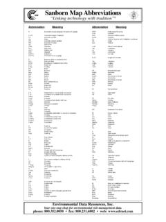
Sanborn Map Abbreviatio ns
web.mit.eduPressure Fire Service” as shown on key map. 5 AF IEP 4 6 2345 ALL (C.B.) (C.B. & BR). Figures 8,12,16 indicate thickness of wall in inches Wall without opening and size in inches alw i th op engsf r d Opening with single iron or tin clad door Opening with double iron or tin clad doors Op en igw th sa rf o Openings with wired glass doors Dr ...

Diagnostic Trouble Code (DTC) Charts and Descriptions
www.cim.mcgill.caApplication Key On Engine Off Key On Engine Running Continuous Memory All GO to Pinpoint Test DM . P0107 - Manifold Absolute Pressure (MAP)/Barometric Pressure (BARO) Sensor Low Description: MAP sensor operating voltage is below the minimum calibrated parameter of 0.25 volts. Possible Causes: Open in the circuit, or short to ground
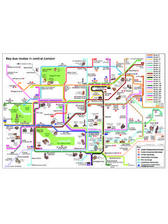
Key bus routes in central London - Transport for London
content.tfl.gov.ukKey bus routes in central London Route 8 Route 9 Route 11 Route 14 Route 15 Route 23 Route 24 Route 25 Route 38 Route 43 Route 59 Route 73 Route 74 Route 139 Route 148 Route 159 Route 188 Route 205 Route 274 ... Map showing key bus routes in central London Created Date: 8/27/2021 8:45:56 AM ...

Seterra
online.seterra.comSeterra EUROPE | COUNTRIES Visit our site online.seterra.com/en for more map quizzes. Russia Belarus Lithuania Latvia Estonia Denmark Moldova Romania Serbia

Mole Conv WS Key - Anoka-Hennepin School District 11
www.ahschools.usCreated Date: 2/23/2015 4:14:14 PM

Weather Map Symbols A B CC At the upper right is the
www.weather.govWeather Map Symbols 77 998 5 -03 71 20 A D B B EF H I B 1 J 2 3 G C In the upper left, the temperature is plotted in Fahrenheit. In this example, the temperature is 77°F. On the second row, the far-left number is the visibility in miles. In this example, the visibility is five miles. The number at the lower left is the dew point temperature ...

Updating Maps on Your Garmin Device
www8.garmin.com5. Enter your product key, if necessary, and click Continue. NoTe: If the product key does not appear automatically, you can view your product key by logging onto your myGarmin account. Click the myMaps tab, and click Details below the map update you want to install. One of the following pages appears: