Example: marketing
SESSION TWO: MID-LATITUDE AND TROPICAL CYCLONES …
Limpopo, Mpumalanga, Gauteng and the northern parts of KwaZulu-Natal. 2.1 Why is it important for the South African Weather Service to issue these weather warnings? (2 x 2) (4) 2.2 Describe the environmental impact this mid-latitude cyclone might have in …
Tags:
Information
Domain:
Source:
Link to this page:
Documents from same domain
Algebra: Expressions, Equations and Inequalities
learn.mindset.africaC {-1, 6] D {-6, 1} Question 3 Solve the quadratic equation xx2 4 1 0. A r45 B r23 C 46 2 r D 1 and -1 Question 4 Which statement best explains why there is no real solution to the quadratic equation = A The value of 12 – 4•2•7 is positive. B The value of 12 – 4•2•7 is equal to 0.
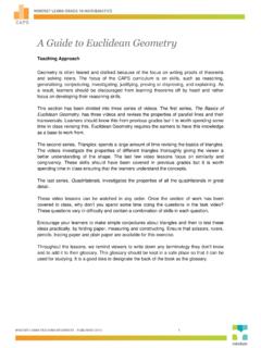
A Guide to Euclidean Geometry - Mindset Learn
learn.mindset.africaThe Basics of Euclidean Geometry 1. What is Euclidean Geometry? This lesson introduces the concept of Euclidean geometry and how it is used in the real world today. This lesson also traces the history of geometry. 2. Revising Lines and Angles This lesson is a revision of definitions covered in previous grades. These include line

LESSON PLAN: Place Value - Mindset Learn
learn.mindset.africaPlace value: The value of a number Flash card: Cards used to work with Place Value. Teaching Method Introduce the vocabulary Hundreds, Tens and Units • Begin with showing a number and asking learners what the number is. • The learner reads out the number. Ask the learner how many digits the number has.

A Guide to Trigonometry for Beginners - Mindset Learn
learn.mindset.africaA Guide to Trigonometry for Beginners Teaching Approach When teaching trigonometry, start with a recap the theorem of Pythagoras followed by
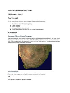
LESSON 6: GEOMORPHOLOGY II SECTION A: SLOPES
learn.mindset.africaAssumed that slopes had two facets- a gently concave lower slope or pediment and a steeper upper slope (scarp). Weathering caused the parallel retreat of the scarp slope allowing the pediment to extend in size X-ample Questions Question 1 Refer to the FIGURE showing elements of a slope to answer the questions. a.)
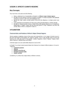
LESSON 3: AFRICA’S CLIMATE REGIONS
learn.mindset.africaThe sub-tropical High Pressure Belt also migrates with the seasonal movement of the overhead sun. ... Isobars that determine wind direction and wind speeds, subsidence and uplift Station models that measure present weather conditions Lines of latitude and longitude to show the position of weather phenomena
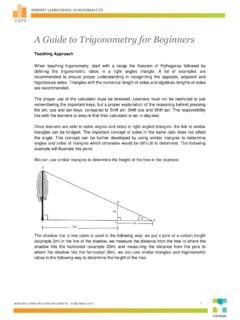
A Guide to Trigonometry for Beginners - Mindset Learn
learn.mindset.africa2: tan 8: tan 20 2 20 2 20 8 8 5 In ABC x In ADE x x xm Other uses of trigonometry and similar triangles must be highlighted to ensure learners see
LESSON 14: TOPOGRAPHIC MAPS Key Concepts
learn.mindset.africaKey Concepts In this lesson we will focus on summarising what you need to know about: Locating exact position (degrees, minutes and seconds) Relative position, direction and magnetic bearing Scale: word, ratio and line scale Distance: Measuring distances and converting to ground distance along a straight line
A Guide to Number Patterns, Sequences and Series
learn.mindset.africaand the nth term of linear number patterns. 2. Quadratic Number Patterns In this lesson the general form of a quadratic sequence is introduced, learners are taught how to recognise a quadratic sequence by finding a constant second difference. 3. The General Term of …
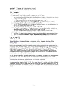
Global Air Circulation - Mindset Learn
learn.mindset.africahigh pressure exist over the Polar Regions due to differences in temperature. Insolation received by the Earth, and converted to heat, causes air to become less dense and rise in equatorial areas. The resulting low pressure allows the high-pressure subsidence air at the poles to move along the planet´s surface toward the Equator.
Related documents
Published by Statistics South Africa, Private Bag X44 ...
www.statssa.gov.zaMap 4.7-1: Gauteng: Urban areas (1996 and 2001) 51 Map 4.7-2: Gauteng: Baviaanspoort and Baviaanspoort Prison urban areas (1996 and 2001) 52 Map 4.7-3: Gauteng: Orient Hills urban areas (1996 and 2001) 53 Map 4.7-4: Gauteng: Sehlakwana urban areas (1996 and 2001) 54 Map 4.7-5: Gauteng: Vergenoeg in Saulsville urban areas (1996 and 2001) 55

Chapter 5 Human settlements
www.dffe.gov.zawas in Gauteng and the Western Cape, and the lowest in the Free State, the Eastern Cape and KwaZulu-Natal (Table 5.1). The two provinces most affected by out-migration in terms of inter-provincial migration are Limpopo and the Eastern Cape.
GRADE 10 NOVEMBER 2020 GEOGRAPHY P1 (EXEMPLAR)
howandwhen.org(larger/smaller) than the 1: 10 000 scale of the orthophoto map. (1 x 1) (1) (c) The feature found at grid location 34°04′55″S/24°45′ 57″E is a (dam/trigonometrical beacon). (1 x 1) (1) 3.1.2 Refer to the feature numbered 1 on the orthophoto map. Calculate in km2, the area of the feature numbered 1 on the orthophoto map.

NATIONAL
www.education.gov.za3. You are provided with a 1 : 50 000 topographic map (2731BC PONGOLA) and an orthophoto map (2731 BC 13 PONGOLA) of a part of the ma pped area. 4. You must hand the topographic map and the orthophoto map to the invigilator at the end of this examination session. 5. You may use the blank page at the end of this question paper for all rough work