Transcription of CAD Manual - Seattle
1 Updated: August 27, 2018 CAD Manual Inter-Departmental CAD Standard City of Seattle CAD Manual - Inter-Departmental CAD Standard ii CAD Manual CAD Manual Table of Contents Introduction ..1 CAD Requirements for Consultants .. 1 Supported Software Version .. 1 2 Tracking Numbers .. 2 Obtaining a Project Tracking Number (PTN) for SPU Projects .. 2 Obtaining a Project Tracking Number (PTN) for SDOT Projects .. 2 Obtaining Vault Plan and Serial Numbers .. 2 Common Abbreviations .. 3 The Highlights .. 3 SECTION 1: Workflow for Civil Projects ..4 Base Map Creation Workflow .. 5 Design Drafting Approach .. 6 Typical Design Drafting Workflow .. 7 Record Drawing Workflow .. 8 SECTION 2: Support Files ..9 Support Files Disclaimer of Warranties .. 9 9 AutoCAD Civil 3D Templates .. 10 Survey Drawing Template .. 10 Design Drawing Template .. 11 Title Block Template .. 12 Additional Support Files .. 17 Survey Line Code Set and Figure Prefix Library.
2 17 Hatch Patterns .. 17 Civil 3D Pipe Network Catalog .. 17 Plot Style Table (.CTB) Files .. 17 City of Seattle CAD Manual - Inter-Departmental CAD Standard iii CAD Manual AutoCAD Plotter Configuration File .. 17 Fonts .. 17 Linetypes .. 17 Blocks .. 17 Reference drawings .. 17 Object Classification .. 17 Pay Items .. 18 Planning Documentation: BIM Execution Plan .. 18 Data Requirements .. 18 Horizontal Asset Onboarding .. 18 Vertical Asset Onboarding .. 19 Custom Civil 3D Pull-Down Menu .. 19 SECTION 3: Project Data Sharing .. 20 Folder Structure .. 20 Sheet Set Manager .. 21 SPU/SDOT Title Block Overview .. 21 Sheet File-Naming Convention .. 24 Drawing Numbers .. 24 View Planning .. 25 Sheet Index Planning .. 27 XREFs .. 28 XREF File-Naming Convention .. 28 Detail View Naming .. 29 Placing XREF Views on Sheets .. 30 Creating Civil 3D Data in XREFs .. 32 Data Shortcuts and Data Referencing .. 33 Civil 3D DREF Drawing File-Naming Convention.
3 33 Data Shortcuts in a Shared Working Environment .. 34 SECTION 4: Drawing Guidelines .. 35 Overview .. 35 General Drafting Guidelines .. 35 Planning and Setup .. 36 City of Seattle CAD Manual - Inter-Departmental CAD Standard iv CAD Manual Annotation (Viewport Zoom) Scale Guidelines for Plan Views .. 36 Presentation Standards Checklists .. 37 Title Blocks .. 37 Cover Sheet Presentation .. 37 Survey Control Presentation .. 38 General Plan & Profile Sheet Presentation .. 39 Removal/Demolition Plan Presentation .. 40 Construction Stormwater Erosion Control (CSEC) Plan Presentation .. 40 Paving Plan Presentation .. 40 Intersection Geometry Plan Presentation .. 41 Paving Profile Presentation .. 46 Paving Cross Section Presentation .. 46 Sewer, Storm Drain, and Water Main Plan Presentation .. 47 Sewer, Storm Drain, and Water Main Profile Presentation .. 47 Detail & Section Presentation .. 49 QC Markup Guidelines .. 50 SECTION 5: Layers.
4 51 Layer Fields: Discipline Designators .. 51 Layer Fields: Major Group .. 52 Layer Fields: Minor 54 Layer Fields: Status .. 58 Layer Color Guidelines .. 59 Common Layer Names .. 59 Sheet Annotation .. 59 Legal .. 60 Site/Topo Features .. 63 Utilities .. 68 Roadways .. 72 Details .. 77 As-Built and Record drawings .. 77 External References .. 78 SECTION 6: Linework and Data .. 79 City of Seattle CAD Manual - Inter-Departmental CAD Standard v CAD Manual Drafting Existing Features on Base 79 Blocks .. 79 Horizontal/Conveyance Assets: Drafting Proposed Utilities in Plan .. 80 Best Practices for 2D Utility Drafting .. 81 Designing Utilities with AutoCAD Civil 3D Pipe/Pressure Networks .. 86 Best Practices for Designing in 3D and Drafting in 2D .. 86 Drafting Proposed Utilities in Profile .. 86 Vertical Assets: Drafting Equipment & Schedules .. 87 Drafting Proposed Paving and Grading Plans .. 88 Drafting Proposed Paving and Grading Profiles.
5 88 Drafting Proposed Landscaping and Irrigation Coverage Plans .. 88 Hatch Patterns for Proposed Utilities, Paving & Vegetation .. 88 Exporting LandXML for Field Verification .. 89 Drafting As-Built and Record Drawing Utility Linework .. 89 CAD to GIS .. 90 List of Horizontal/Conveyance CAD Attributes .. 90 Object Classification for Proposed and Record Drawing Utilities .. 90 Asset Data Requirements .. 91 SECTION 7: 94 Text Styles .. 94 Text Color and Size Chart .. 94 Notes .. 95 Street Names .. 95 Sheet Match Lines .. 96 Sheet Profile Grid Stationing .. 96 Annotative Text, Dimensions, & Multileaders .. 97 Annotative Scale List .. 97 Dimension Styles .. 97 Dimensions for Proposed Features .. 97 Dimensions for Existing Features .. 97 Multileader Styles .. 98 Multileaders for Proposed Features .. 98 City of Seattle CAD Manual - Inter-Departmental CAD Standard vi CAD Manual Multileaders for Existing Features .. 98 General Multileader Guidelines.
6 98 Loop Leaders .. 99 Loop Leaders for Pipe Networks .. 99 Loop Leaders for Classified Objects .. 99 Key Note Label Format .. 100 Grading Label Formats .. 100 Curb Return Label Format .. 101 Table Styles .. 101 Reference 101 Detail and Section Referencing (Reference Callouts) .. 102 SECTION 8: Plotting/Printing .. 103 Page Setups .. 103 Plot Style Tables (pen assignments).. 103 Paperless Plotting .. 104 DWF Format (optional, for reviews) .. 104 PDF Format (required) .. 104 DWF/PDF File-Naming Convention .. 105 SECTION 9: Electronic Transmittals .. 106 Submitting CAD Files and Data to SPU and SDOT .. 107 Submitting to Seattle Public Utilities .. 107 Submitting to Seattle Department of Transportation .. 107 SECTION 10: Submittals .. 108 Pre-Submittal Checklist .. 108 30% CAD Submittals .. 108 60% CAD Submittals .. 108 90%, 100% (Advertised/Conformed Set) & Record Drawing CAD Submittals .. 108 Submittal Requirements .. 109 30% 109 60%, 90%, and 100% Pre-Final Submittals.
7 109 100% Advertised/Conformed Drawing Set Submittals .. 109 As-Built and Record Drawing Submittals .. 109 City of Seattle CAD Manual - Inter-Departmental CAD Standard vii CAD Manual 110 Change Log .. 111 City of Seattle CAD Manual - Inter-Departmental CAD Standard viii CAD Manual Preface We believe that corporate data is as important and critical of an asset to the City as our physical infrastructure. Managing enterprise-wide corporate data is essential to our success and enhances the data-driven decision-making mode that helps us to manage the City s assets. Creating CAD documents to a common standard puts the City of Seattle in better control of our engineering data. Using this inter-departmental CAD standard will make our engineering data compatible with GIS and other systems used to track and manage assets. It will also make it easier for people in our departments to work effectively together using concurrent engineering principles and allows us to more easily re-use and build on data for future projects, studies, or initiatives.
8 Over time, this effort should help our departments realize more efficiency for data reuse and as a result help us better control costs. If you have any questions regarding this standard, please contact us at City of Seattle CAD Manual - Inter-Departmental CAD Standard 1 Introduction Introduction The City of Seattle Inter-Departmental Computer-Aided-Drafting (CAD) Standard was set in place to ensure that all CAD drafting work performed in house or by a city-hired consultant could be readily used by various city departments and easily translated into the city s GIS network. Contract plans result from the work of many specialists and engineers. A base map may be used simultaneously by disciplines such as water design, drainage design, sewer design, roadway design, landscaping design, etc. All the disciplines of a project fit against the base map, making it possible to compare and complete various design elements in tandem. This ability to work concurrently depends on developing, maintaining and employing CAD standards.
9 The goals of maintaining coherence, minimizing wasted effort in recreating design, and maximizing the effectiveness of a project team are all best served by adhering to the CAD standard. The chart below shows a typical project drawing/data lifecycle: CAD Requirements for Consultants If you are performing computer-aided-drafting (CAD) services for the City of Seattle you must adhere to the requirements in the Design Drafting Guidelines document found here: Supported Software Version The civil mapping/design/plan production software supported by the City of Seattle is Autodesk AutoCAD Civil 3D 2017. Survey Base Map & DataDesign drawings & DataSurvey Staking for ConstructionConstruction Red-LinesAs-Built drawings & DataRecord drawings & DataGIS City of Seattle CAD Manual - Inter-Departmental CAD Standard 2 Introduction Disclaimer This CAD Manual ( Document ) should not be used as a substitute for codes and regulations. The applicant is responsible for compliance with all code and rule requirements, whether or not described in this Document.
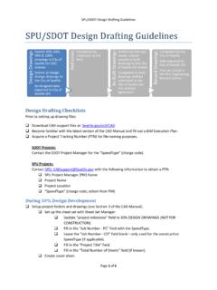
10 This Document contains Autodesk AutoCAD and Autodesk AutoCAD Civil 3D usage tips and instructions which are for reference only and are not a replacement for formal training. Contact an Autodesk Certified Instructor for training opportunities. Tracking Numbers A project tracking number is a unique tracking number used for file-naming (see SECTION 3: Project Data Sharing) during and after the pre-construction phase of a project. Once a drawing set has entered the 60% design phase, Vault Plan and Serial numbers are also obtained and added to the title blocks via Sheet Set Manager. Obtaining a Project Tracking Number (PTN) for SPU Projects Prior to setting up drawing files, contact with the following information to obtain a PTN: 1. SPU Project Manager (PM) Name 2. Project Name 3. Project Location 4. SpeedType (charge code; obtain from PM) Obtaining a Project Tracking Number (PTN) for SDOT Projects Prior to setting up drawing files, contact the SDOT Project Manager for the SpeedType (charge code).