Example: bachelor of science
Crater Lake U.S. Department of the Interior
road around Crater Lake. More than 30 an island that seems to be sailing away. To pullouts ofer excellent views of the park’s see it, walk to Sun Notch or drive to the scenery. Allow 2 to 3 hours (see page 5). viewpoint named in its honor (see page 5). Photograph the Pinnacles . Have a Picnic . Formed by the same eruption that gave
Tags:
Information
Domain:
Source:
Link to this page:
Documents from same domain

PLEASE NOTE - National Park Service
www.nps.govTechnical Preservation Services National Park Service 2012 T his booklet describes the Federal Historic Preservation Tax Incentives in general terms only.
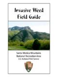
Invasive Weed Field Guide
www.nps.govThis field guide is not intended as a comprehensive reference to all of the weeds in the Santa Monica Mountains National Recreation Area (SMMNRA).

Yosemite, CA 95389 PO Box 577 National Park Service
www.nps.govi The Ansel Adams Gallery Half Dome Village Parking E3 E6 E4 Merc e d Ri v er Lower Yosemite Fall Upper Yosemite Fall Vernal Fall Nevada Fall Bridalveil Fall B r i d a l v e
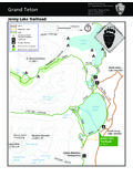
Grand Teton - NPS.gov Homepage (U.S. National …
www.nps.gov8,000 8,000 8,000 10,000 8,000 10,000 10,000 10,000 12,000 JENNY LAKE Lake of the Crags Grand Teton Teton Glacier 13,770 ft Mount Owen 12,928 ft Teewinot Mountain
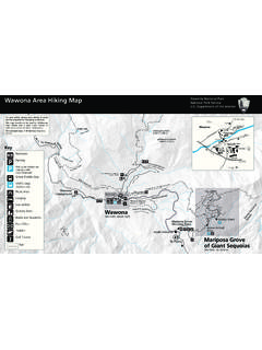
Wawona Area Hiking Map - National Park Service
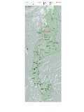
www.nps.govWawona Area Hiking Map. Yosemite National Park National Park Service. U.S. Department of the Interior. h. hilnualna Falls, ft , m Wawona eadow, ft , m

Backcountry Permit Request - National Park Service
www.nps.govNOTICES . Notice Regarding the Use of Cell/Satellite Phones and Personal Locator Beacons. Communication devices may be helpful, but do not guarantee your …
ARCHES NATIONAL PARK
www.nps.govNorth 0 0 1 1 2 2 3 3 4 Miles 4 Kilometers 191 191 279 128 128 313 70 191 313 313 313 70 191 128 191 128 191 191 C O L O R A D O S KC Visitor Center R …
BRYCE CANYON NATIONAL PARK - NPS.gov …
www.nps.gov087 12 63 89 No trailers beyond this point Road closed from here to Rainbow Point during winter storms BRYCE CANYON NATIONAL PARK Riggs Spring Iron Spring
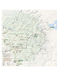
YOSEMITE NATIONAL PARK
www.nps.gov120 167 120 140 41 395 Fish Camp Lee Vining Yosemite West Chinquapin El Portal Foresta Mather To Fresno To Merced To Manteca To Carson City, Nev. To …
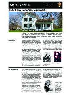
National Park Service Women’s Rights U.S. …
www.nps.govGrowing Up Life in Seneca Falls Elizabeth Cady was born in Johnstown, New York on November 12, 1815, the daughter of Daniel Cady, a lawyer, a judge, and land specu-
Related documents

Lazy 8 Breathing - Mindfulness - TRAILS to Wellness
storage.trailstowellness.orgPlace your finger in the middle of the 8 and begin slowly tracing your finger around it. As you move around one side of the 8, breathe in, and as you move to the other side, breathe out. Repeat several times. b r e a t h e i n b r e ath o u t TRAILStoWellness.org

Davis Mountains State Park Trails Map - Texas
tpwd.texas.govExplore trails that range from high adventure to peaceful strolls. Whether you’re a mountain biker, birder, equestrian, hiker or trail runner, Davis Mountains State Park offers what your heart desires. Scenic vistas and abundant wildlife are around every corner. Breathe in the mountain air and experience the

Mindfulness for Teens - TRAILS to Wellness
storage.trailstowellness.orgLook around you and notice 5 things you hadn’t noticed before. Maybe a pattern on a wall, light reflecting from a surface, or a knick-knack in the corner of a room. What are 4 things you can feel? Maybe you can feel the pressure of your feet on the floor, your shirt resting on your shoulders, or the temperature on your skin. Pick up an
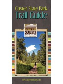
Custer State Park Trail Guide - South Dakota
gfp.sd.gov• Trails within Custer State Park are marked with blue diamonds. The Centennial Trail is marked with gray diamonds and brown fi berglass posts. Trails in the Black Hills National Forest are marked with tree blazes. • Water is not available along the trails. Always carry water with you. • Camping within Custer State Park is only allowed

For assistance using this map, contact the park. Enchanted ...
tpwd.texas.govWhen hiking the trails, take a quart of water per person per mile and pack out what you pack in. N Texas State Parks Store T-shirts, caps and one-of-a-kind gift items are available at the Texas State Park Store located in our park headquarters building..58.71 or Buzzard Roost Group .30.31 1.30.57.22.33.77.41.10.18 1.0.38.39.40.20.16.21 .24.42
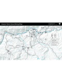
Glacier Point Area Hiking Map - NPS
www.nps.govThe Sentinel Dome and Taft Point trails can be combined into a loop hike. For a. counterclockwise loop, start by hiking Sentinel Dome’s northeast side as described previously. After descending the same northeast slope, follow the trail north to the Pohono Trail junction. Take the Pohono Trail southwest, descending to Sentinel Creek before ...