Example: marketing
GEORGIA - Counties
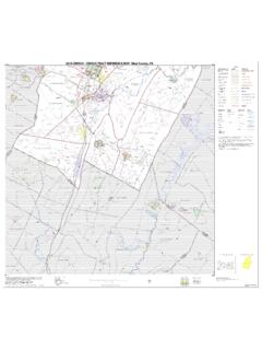
Jan 01, 2000 · 0 8 16 24 32 40 miles 0 8 16 24 32 40 kilometers polk bibb tift telfair early glascock burke gilmer cobb chatham ware brantley echols lee dooly crisp taylor macon
Information
Domain:
Source:
Link to this page:
Documents from same domain
Maps - Census
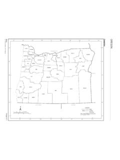
www2.census.govMaps Oregon E-3 U.S. Census Bureau, 2010 Census COUNTY MAP SEC Baker 3 Benton 1 Clackamas 1 Clatsop 1 Columbia 1 Coos 6 Crook 2 …
Maps - Census
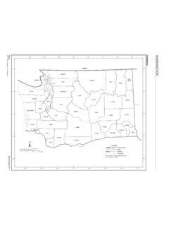
www2.census.govThe county subdivision name is shown only if different than the name of the place. Section Locator. Maps Washington E-3 U.S. Census Bureau, 2010 Census COUNTY MAP SEC Adams 5 Asotin 5 Benton 5 Chelan 3 Clallam 1 Clark 6 Columbia 5 Cowlitz 6 Douglas 3 Ferry 4 Franklin 5 Garfield 5 Grant 3 Grays Harbor 1 Island 2 Jefferson 1 …
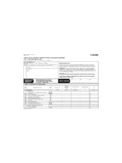
Michigan Department of Treasury 3965 (Rev. 4/05) …
www2.census.govLocal Unit Identification FORM F-65(MI) (4-14-2005) Michigan Department of Treasury F-65(MI) 3965 (Rev. 4/05) ANNUAL LOCAL UNIT FISCAL REPORT FOR FISCAL YEARS ENDING BETWEEN
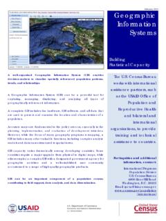
Geographic Information Systems - census.gov
www2.census.govGeographic Information Systems . Building . Statistical Capacity . The U.S. Census Bureau works with international assistance partners, such as the USAID Office of
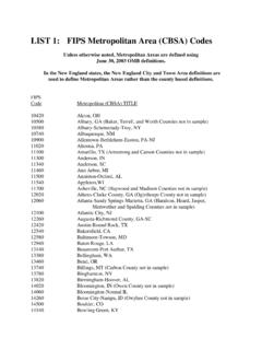
LIST 1: FIPS Metropolitan Area (CBSA) Codes
www2.census.govLIST 1: FIPS Metropolitan Area (CBSA) Codes ... the New England City and Town Area definitions are ... 11500 Anniston-Oxford, AL
Population by Region and Country: 1950-2050
www2.census.govRegion and country or area 1950 1960 1970 1980 1990 2002 2010 2025 2050 .Vietnam 25,348 31,656 42,577 53,661 66,637 80,577 89,223 104,436 116,813 LATIN AMERICA AND THE
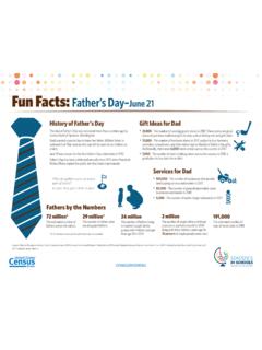
Fun Facts: Father’s Day–June 17 - census.gov
www2.census.govFun Facts: Father’s Day ... Sources: Data on this page come from the U.S. Census Bureau’s 2014 Survey of Income and Program Participation, 2017 Current Population Survey, and 2016 County Business Patterns. Fathers by the Numbers 72 million* The estimated number of fathers across the nation.
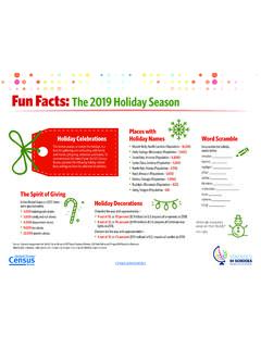
Fun Facts: 2017 Holiday Season - Census
www2.census.govCENSUS.GOV/SCHOOLS Fun Facts: The 2017 Holiday Season Holiday Celebrations This festive season, or simply the holidays, is a time for gathering and celebrating with family
2010 Census - Census Tract Reference Map
www2.census.govCanoe Creek State Park Blue Knob State Park State Gamelands No 41 Warriors Path State Park State Gamelands No 41 F ra n k s t o w n Hollidaysburg° B r a
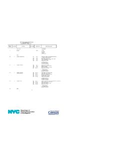
New York City Housing and Vacancy Survey 2017 Record ...
www2.census.govNew York City Housing and Vacancy Survey 2017 Record Layout Household Record -- Occupied Units 1 Record Type 1=OCCUPIED 2
Related documents
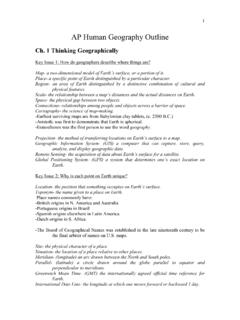
AP Human Geography Outline - Springfield Public Schools
www.sps186.org-Earliest surviving maps are from Babylonian clay tablets, (c. 2300 B.C.) -Aristotle was first to demonstrate that Earth is spherical. -Eratosthenes was the first person to use the word geography. Projection- the method of transferring locations on Earth’s surface to a map.

Outline Maps - NASA
er.jsc.nasa.govOutline Maps Outline Map of Asia Outline Map of Antarctica Outline Map of the Eastern Hemisphere Outline Map of the Former Soviet Union Outline Map of the Mediterranean Outline Map of Middle America Outline Map of North America Outline Map of South America Outline Map of Southeast Asia Outline Map of U.S.-Mexican Border Outline Map of the ...
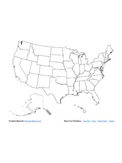
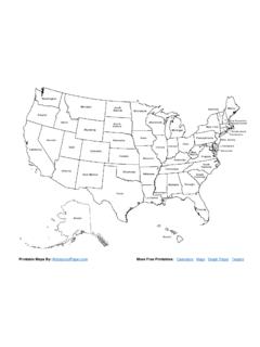
Printable Maps By: More Free Printables: Maps
www.waterproofpaper.comPrintable Maps By: WaterproofPaper.com More Free Printables: Calendars Maps Graph Paper Targets
Printable Maps By: More Free Printables: Maps
www.waterproofpaper.comPrintable Maps By: WaterproofPaper.com More Free Printables: Calendars Maps Graph Paper Targets

Outline of Educational Learning Theories and Theorists
edu479-2015.weebly.comOutline of Educational Learning Theories and Theorists Theorist Theory Description Ausubel Subsumption Theory Mechanism by which new material presented ... using whatever mental maps they have constructed. If the experience is a repeated one, it fits easily - or is assimilated - into the child's cognitive structure so that they maintain mental ...

WWW.FREEWORLDMAPS
www.freeworldmaps.netWWW.FREEWORLDMAPS.NET. Created Date: 1/7/2021 10:59:23 AM
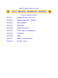
CLASS G - GEOGRAPHY. ANTHROPOLOGY. RECREATION
www.loc.govG3180-9980 Maps G3180-3182 Universe. Solar system G3190-3191 Celestial maps G3195-3197 Moon G3200-3202 World. Earth G3210-3221 Northern and Southern Hemispheres G3240-3241 Tropics. Torrid Zone G3250-3251 Temperate Zone G3260-3272 Polar regions. Frigid Zone G3290-9880 By region or country G3290-5667 America. Western Hemisphere G3300-5184 …
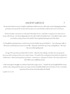
AC Greece FINAL copy
aurorak12.orgANCIENT GREECE The ancient Greeks lived in an area along the northeastern Mediterranean Sea, with a wide variety of topography: mainland, peninsulas and many islands.

PENNSYLVANIA - Counties
www2.census.govJan 01, 2000 · 0 8 16 24 32 40 miles 0 8 16 24 32 40 kilometers elk erie mercer greene centre perry juniata union snyder berks pike luzerne lycoming crawford warren venango clarion