Transcription of Geographic Information Systems - census.gov
1 Geographic Information Systems Building Statistical Capacity The Census Bureau works with international assistance partners, such as the USAID Office of Population and Reproductive Health and bilateral and international organizations, to provide training and technical assistance to countries. For inquiries and additional Information , contact: International Programs Population Division Census Bureau 4600 Silver Hill Road Washington, 20233 Email: /international A well-organized Geographic Information system (GIS) enables decision-makers to visualize spatially referenced population patterns, trends, and relationships.
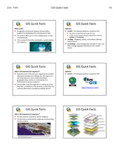
2 A Geographic Information system (GIS) can be a powerful tool for capturing, managing, displaying, and analyzing all types of geographically referenced Information . A complete GIS includes the hardware, GIS software, and all data that are used to present and examine the location and characteristics of a population. Accurate maps are fundamental to the policy process, especially in the planning, implementation, and evaluation of development initiatives. However, while the focus of many geography programs is mapping, a GIS includes many other valuable functions, including complex analytic models and databases structured in spatial terms.
3 GIS capacity varies dramatically among developing countries. Some countries require a major upgrade from physical to digital maps, while others employ a complex GIS with a designated government agency for Geographic activities and a well-established user community accustomed to a range of high-quality Geographic products. GIS can be an important component of a population census, contributing to field support, data analysis, and data dissemination. February 2013 GIS improves the efficiency and quality of censuses and surveys conducted by a national statistical office.
4 The Census Bureau offers technical assistance and training in several aspects of census mapping: Field Support: Field maps and address lists generated by a GIS are valuable tools for data collection efforts.
5 Throughout the enumeration process, GIS is used to facilitate field operations. A GIS can be used to design and digitize enumeration areas, help create a place coding (p-code) system , predetermine coverage areas, and prepare maps in advance of the census. Global Positioning system (GPS) units, satellite imagery, and/or airphotos can also be used with a GIS to help create or revise enumeration area maps. Post-enumeration, GIS is key for evaluation of data coverage and quality. Mapping process assessment: The most efficient mapping technique will usually vary geographically within a country, especially among urban and rural or more and less densely populated areas.
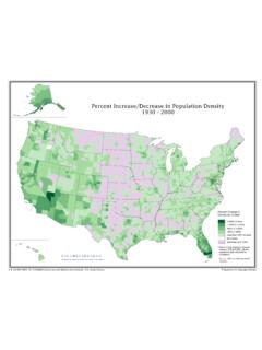
6 An assessment of current mapping methods and staff resources will help determine the mix of traditional field mapping, GIS and GPS work, and image analysis that will produce the best quality census mapping, while minimizing time and expense. Data Analysis: Visualizing the distribution of multiple population characteristics on a map is a powerful aid in understanding economic, health, and demographic patterns from the local to the national scale. Data Dissemination: A GIS can generate data sets and maps for any type of Geographic area, including enumeration areas, cities, districts, or regions, showing spatial patterns in demographic, health, housing, economic, and other data.
7 Thematic maps using census data can be designed for paper or online distribution to meet the needs of government, the private sector, universities, non-profit organizations, and the general public. This is one in a series of fact sheets introducing the Census Bureau and the assistance it provides to countries around the world. The Census Bureau helps countries improve their national statistical Systems by engaging in statistical capacity building activities that aim to enhance competencies in several areas in sustainable ways.
8 Topics in this series include: Statistical Capacity Building CSPro Processing Census and Survey Data Population Census Demographic and Economic Analysis Socioeconomic and Demographic Surveys Geographic Information Systems Population Estimates and Projections Courses and Workshops The Tool for Assessing Statistical Capacity (TASC)