Transcription of GIS quick facts - University of Memphis
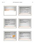
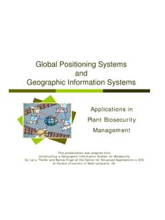
1 GIS quick FactsWhat is GIS? geographic information Systems (GIS) provide a platform for displaying and analyzing spatial data. GIS systems allow you to view multiple layers of data simultaneously. GIS is a powerful tool for visualization, spatial analysis, and quick FactsWhy is GIS important for engineers? Engineers must make decisions regarding the possible alternative locations for a design and the impact of a particular decision, must model and analyze geographic data, and must communicate this information to various audiences. GIS provides a way for engineers to overlay all of the data that is important to the decision, so that they can evaluate alternatives considering multiple factorsGIS quick FactsWhy is GIS important for engineers? GIS also provides a platform spatial modeling. GIS provides a visual tool for analyzing and presenting decision dimensional image of the San Francisco Bay created to assess the potential of land and underwater quick FactsSoftware ArcGIS GIS software platform created by ESRI.
2 We will be using ArcGIS exclusively this year. ArcGIS contains several software applications, including ArcMapand ArcCatalog. ArcMap Mapping, editing, and analysis software within ArcGIS. ArcCatalog Data management software (create new files, manage database information , etc.) within ArcGIS. GIS quick FactsSoftware ArcGIS GIS software platform created by ESRI. quick FactsCIVL 1101 GIS quick Facts1/5 GIS quick FactsKey Terminology Project This is a session in ArcMap. You can save a project so that you can return to the session and continue working. The project will contain all datasets you imported, any maps you have created in the project, all symbology(the look of your data) changes you have made, and any new data features you created through analysis. When you save a project, it has a *.mxd quick FactsKey Terminology Feature Class Data file containing a group of geographic data of the same type (point, line, or polygon).
3 (1) manhole cover locations as points (2) sewer lines(3) parcel polygons(4) street name annotationGIS quick FactsKey Terminology Feature Class Points Features that are too small to represent as lines or polygons as well as point LocationsGIS quick FactsKey Terminology Feature Class PointsAccident LocationsHistoric SitesGIS quick FactsKey Terminology Feature Class Lines Represent the shape and location of geographic objects, such as street centerlines and streams, too narrow to depict as areas. Linesare also used to represent features that have length but no area such as contour lines and quick FactsKey Terminology Feature Class LinesContour MapTransportation NetworkCIVL 1101 GIS quick Facts2/5 GIS quick FactsKey Terminology Feature Class LinesUtilities NetworkHydrologic NetworkGIS quick FactsKey Terminology Feature Class Polygons A set of many sided area features that represent the shape and location of homogeneous feature types such as states, counties, parcels, soil types, and land use quick FactsKey Terminology Feature Class PolygonsBoundary or Parcel DataBoundary DataGIS quick FactsKey Terminology Feature Class Annotation Map text including properties for how the text is rendered.
4 For example, in addition to the text string of each annotation, other properties are included such as the shape points for placing the text, its font and point size, and other display properties. GIS quick FactsKey Terminology Feature Class Multipoints Features that are composed of more than one point. Multipoints are often used to manage arrays of very large point collections such as LiDAR point clusters which can contain literally billions of points. Using a single row for such point geometry is not feasible. Clustering these into multipoint rows enables the geodatabase to handle massive point quick FactsKey Terminology Feature Class Multipoints Features that are composed of more than one point. CIVL 1101 GIS quick Facts3/5 GIS quick FactsKey Terminology Feature Class Anything on earth can be represented in a GIS as a feature. Consider a golf quick FactsKey Terminology Feature Class Anything on earth can be represented in a GIS as a feature.
5 Course map with quick FactsKey Terminology Feature Class Anything on earth can be represented in a GIS as a feature. Course map with quick FactsKey Terminology Feature Class Anything on earth can be represented in a GIS as a feature. Course map with quick FactsKey Terminology Feature Class Consider a survey site near the U of quick FactsKey Terminology Feature Class Consider a survey site near the U of 1101 GIS quick Facts4/5 GIS quick FactsKey Terminology Feature Class Consider a survey site near the U of quick FactsKey Terminology Feature Class Consider a survey site near the U of detailed information can be found about this presentation at: Questions?GIS quick Factsy QCIVL 1101 GIS quick Facts5/5