Transcription of Global Positioning Systems and Geographic …
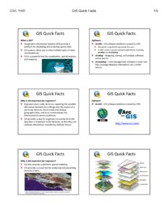
1 Global Positioning Systems and Geographic information SystemsApplications in Plant Biosecurity ManagementThis presentation was adapted from Constructing a Geographic information system for Biosecurity byLarry Thellerand Bernie Engel at the Center for Advanced Applications in GISat Purdue University in West Lafayette, Overview Difference between GPS and GIS Examples of GPS data collection Examples of GIS software output Potential of GPS and GIS technologies in a plant biosecurity management contextGPS versus GISG lobal Positioning system (GPS):A satellite system that projectsinformation to GPS receivers on the ground, enabling users todetermine latitude and longitudecoordinates. Global information system (GIS): Software program that enable users to store and manipulate large amounts of data from GPS and other sources.
2 Examples of GPS and GIS: Global Positioning system (GPS):An agricultural producer may use ahandheld GPS receiver to determine thelatitude and longitude coordinates of awater source next to a field or information system (GIS): Following a chemical spill, maps obtained from a GIS system canreveal environmentally-sensitiveareas that should be protected duringresponse and recovery phases. Source: Purdue UniversityGPS data gatheringDepending on the make and model of theunit, the number of satellites available, and thequality of (unobstructed) signals, GPS receivers cancollect information such as Latitude and longitude coordinates (time-in-place or point location) Real Time position (calculated while farm equipment is moving) Elevation (if 4 or more satellites are used)With GIS software, information from a GPSunit may be combined with data such as USGS topographical maps Digital elevation models Critical infrastructure maps Aerial photography Cropland use Census mapsThe Result.
3 Layered maps can be generated by the GIS of Map Layers A GIS database creates layers withmany pieces of information visualizedfor the same data collected using GPST opsoil Depth -collected using GPSA erial photo of the areaSource: University of MissouriThis layered map shows a potential disaster impact area outlined in white by GIS : Purdue UniversityDid you information and maps have avariety of uses in the agricultural sector,including the potential to assist preparedness,response, recovery,and mitigationefforts in plant biosecurity example: Responding to Plant Biosecurity ProblemSituation: Confirmed case of a plant disease in a small test : Purdue UniversityCase example --continuedFacts: Disease spores may be spread by the wind.
4 Combine used in this field was not disinfected. Two neighbors borrowed the combine. Combine traded and shipped from dealer by rail. Estimated range of movement of disease is one Task:9 Notify all farms within one mile of the infected field, neighbors fields, highway, and , information such as wind direction, speed, and durationare entered in to an existing GIS database for the : Purdue UniversityNext, queries are run to retrieve information from the GISdata base, such as a map of the potential impact dots represent farms in the potential impact particular database allows one to zoom in on the green dots to obtain aerial : Purdue UniversityOther queries can be run, to obtain mapsof highways and railways.
5 Source: Purdue University.. and to identify affected farms withina designated quarantine : Purdue UniversityIf the established GIS database is extensive, detailed information may be obtained, such as producers names, phone numbers, and exact locations, facilitating rapid response efforts. Source: Purdue UniversitySynthesis Questions for Extension Educators: How would you justify the need for a comprehensive GIS database in your area? What types of database reports would be needed to effectively respond to a plant biosecurity outbreak? How can GPS and GIS technologies assist producers mitigation and preparedness efforts?Key Points to Remember GPS is a system of satellites. Receivers identify point-specific and real-time locations GIS software programs can merge data from GPS and numerous other sources Maps and tables from GIS programs can facilitate responders fast and accurate response to a plant biosecurity problem GPS and GIS technologies can assist producers mitigation and preparedness efforts by identifying potential impact areas and areas vulnerable to intentional and unintentional biosecurity problemsReferencesDavis, G.
6 , Casady, W. & Massey, R. (1998). Precision Agriculture: An Introduction. Publication Number WQ450. University of Missouri-Columbia. Pfost, D., Casady, W., & Shannon, K. (1998). Precision Agriculture: Global Positioning system (GPS). Publication Number WQ452. University of Missouri-Columbia. Theller, L., and Engel, B. (2004). Constructing a Geographic information system for Biosecurity. Center for Advanced Applications in GIS, Ag and Biological Engineering Department, Purdue thanks to Larry Thellerand Kent Shannon for helping to review this your information ..Now return to Lesson 5, Teaching Scenario 2