Transcription of Cost-Benefit Analysis for Geographic Information …
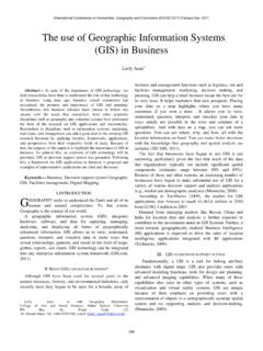
1 HOME / COORDINATION PROGRAM / REPORTS AND PRESENTATIONSCost-Benefit Analysis for Geographic Information SystemImplementation Justification(Literature Review)Submitted to Bruce OswaldChair of the NYS GIS Coordinating Bodyby Eliane SilvaMarch 4, 1998 GIS Success StoriesA Geographic Information system (GIS) is an electronic Information system that analyzes, integrates, and displays Information based on systems have powerful visual display capabilities that present the results of Analysis on maps on a wide variety of scales, ranging from very large(accurate to within inches) to very small (accurate only in broad overview). GIS is regarded as the best technology to understand and solve problemsassociated with government Information which has a Geographic dimension--a street address, a transportation corridor, a river, a city line.
2 Someexamples of how GIS has been used to increase government efficiency are:In 1995, the city of Philadelphia (CA) used GIS to optimize their garbage truck routes. In the following year the city saved over $1million in overtime. (Koutnik, 5)The state of Wyoming used its GIS to audit the mass appraisal process and found that approximately 250,000 parcels were not on thetax rolls. (6)The city of Ontario (CA) generated $190,000 per year in lost business license fees by using GIS to audit their billing files.(8)In 1996, the city of Scottsdale (AZ) had only 3 weeks in which to respond and challenge the numbers provided by the Census Bureau'smid-decade census. Due to the city's GIS database the challenge was approved, resulting in increased per capita revenues to the city of$ million per year for the next five years - a total of $9 million.
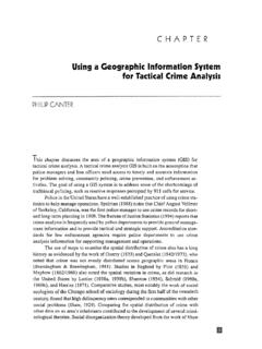
3 This response was possible because the city had GISavailable.(Ledbetter, 64)The city of Redlands (CA) has used ArcView for crime Analysis . They have been able to determine crime patterns which allows them tofocus police activities in target areas to reduce crime. They were also able to justify altering police beats to focus theirresources.(Koutnik, 8)The Metropolitan Sewer District (Cincinnati, OH) used GIS to find parcels with sewer connections which were not being billed. The Districtgenerated thousands of dollars of missing revenue that more than covered the cost of their GIS. (5)In Portage County (WI) an assistant in the county clerk's office typically would spend over 4 days to prepare the documentation requiredfor rezoning hearing.
4 Using GIS, the process gets done in about half a day. (6)The Los Angeles County Assessors Office has reduced their yearly overtime hours from 1200 to zero, while at the same time reducingstaff from 55 to 45. The cost and staff saving have been generated by a more automated assessor map creation and reproductionmethodology with GIS. (8) GIS Benefit/Cost RatiosDespite all the difficulties in quantifying major GIS benefits , there is a particularly useful study that presented examples of the productivityimprovements and cost savings produced by GIS -- the Joint Nordic Project Report. This report presented Information on costs, benefits , andapplications of 16 well established GIS projects in North America and two in Italy.
5 This study is considered by many authors as the best singlereference for detailed Benefit/Cost ratio data.(Korte, 49) The project findings were:If a system is used only for computer-aided mapping and updating, it gives a full return on investment (B/C 1:1).If the system also is used for planning and engineering purposes, the investment will be doubled (B/C 2:1).The ratio would rise to 4:1where all commonly used data sets have been reports publish in Norway and Sweden show that the B/C ratio for automating conventional maps is greater than 3 a common system is created in which Information can be shared among different relevant organizations, the investment will comeback four times (B/C 4:1).For organizations with a poor system for manual map production, the automated system has given B/C ratios up to 7:1.
6 (49)Alternatives for GIS Investment JustificationRigorous economic evaluations in GIS purchase justification are rare.(Prisley, 30) The dominant approach is to justify GIS investment basedon the following reasons: improve efficiency of services, respond to regulatory requirements, and accomplish a stated goal, mission orobjective.(Koutnik, 3)There are some important aspects of a GIS project that can make the process of justifying investment in GIS technology (GISt) quitecomplex. First, in many instances a Geographic Information system can create an opportunity for a department or organization to performnew data Analysis that is not possible without GIS technology and, consequently, not comparable with any of the department pre-GISoperations.
7 Generally, these new capabilities are usually hard to express in financial terms (intangible benefits ). However, a literature reviewrevealed that these new capabilities are frequently considered as the strongest arguments for having a GIS.(Stutheit, 69) Second, a GIS canrange from one single, well-defined application in one department to an enterprise-wide GIS. In addition, the strongest arguments may alsobe the ones that often would arise many years after project is sought for many governments to improve their operational efficiencies on providing services to the public. Nonetheless, this is also anrestraint in the justification process since there is no market prices for services that are consumed within government.
8 Tomlinson (1992)emphasized two alternatives to address this issue. One is to use the standard approach which assumes that "products consumed withingovernment have a value or benefit equal to their cost of production."(248) The second alternative is through comparison. Government staffmight identify government services that are provided by the private sector in similar first part of this GIS justification Analysis effort would be to determine who will benefit from having GISt available. The user group isbroken into two different categories: user and potential user. The first is, in general, defined "as a person who uses the system for production,or who works with the products developed by the system .
9 [..] [Potential user] is someone who cannot use the present system because ofsome constraint, but could become a user of the system if it were converted." The city of Ottawa, Canada, in its process of GISt justificationconsidered that the following groups would benefit directly or indirectly from its new and its departments for both existing and new products;Taxpayers who will benefit from new services;Private sector organizations, including construction firms, planners, architects, real estate firms and a wide variety of others who wouldhave a willingness to pay for GIS products;Other related government organizations, such as school boards, that will benefit from some GIS successfully justifies GIS investment by quantifying benefits of GIS products through a ranking scheme.
10 The ranking scheme requiresthat each department assess the value of its services and determine how each GIS Information product that could be generated for thatdepartment would affect what the department could do. Most of this evaluation would involve savings in direct costs (staff time, material, andtimely provision for products now produced manually) with minimal subjective judgment. Nevertheless, it is recommended that estimates bereviewed by relevant department heads, and in some situations an external consultant can be hired to confirm their departments of the city of Ottawa that participated of the interviewing process were Engineering and Works, Housing and Property,Planning and Development, Economic Development, Office of the City Clerk, Fire, Recreation and Culture, Legal and Police.