Example: biology
Using a Geographic Information for Tactical Crime …
GEOGRAPHIC INFORMATION SYSTEMS The ability of a GIs to relate and synthesize data from a variety of sources enables analysts to examine various aspects of criminal ...
Tags:
Information
Domain:
Source:
Link to this page:
Documents from same domain
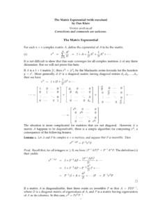
The Matrix Exponential - UMass Lowell
faculty.uml.eduLinear Systems of Ordinary Di erential Equations Suppose that y= f(x) is a di erentiable function of a real (scalar) variable x, and that y0= ky, where kis a …
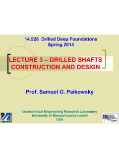
LECTURE 3 – DRILLED SHAFTS CONSTRUCTION …
faculty.uml.eduLECTURE 3 – DRILLED SHAFTS CONSTRUCTION AND DESIGN . ... essentially to deep foundation elements constructed in place, ... local design and construction …

Chapter 6: Series-Parallel Circuits - UMass Lowell
faculty.uml.eduLearning with Purpose Slide 3 Combination circuits Most practical circuits have various combinations of series and parallel components. You can frequently simplify analysis by
“Signal Processing: A Mathematical Approach” - Answers to ...
faculty.uml.edu“Signal Processing: A Mathematical Approach” - Answers to Selected Exercises Charles L. Byrne March 26, 2008
A First Course in Optimization: Answers to Selected Exercises
faculty.uml.eduA First Course in Optimization: Answers to Selected Exercises Charles L. Byrne Department of Mathematical Sciences University of Massachusetts Lowell
Physics for Scientists and Engineers, with Modern Physics ...
faculty.uml.eduA car accelerates along a straight road from rest to 90 km/h in 5.0 s. What is the magnitude of its average acceleration?
Physics for Scientists & Engineers, with Modern Physics, 4 ...
faculty.uml.eduAny vector can be expressed as the sum of two other vectors, which are called its components. Usually the other vectors are chosen so that they are perpendicular to
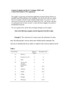
Program Evaluation and Review Technique (PERT) and ...
faculty.uml.eduProgram Evaluation and Review Technique (PERT) and Critical Path Method (CPM) Applications Two simple, yet interesting and important applications of partial ordering relations are the PERT and CPM techniques in job scheduling. See exercise 50 in the text, section

An Overview of Psychological Theories of Crime Causation
faculty.uml.eduPsychological Theory and the Criminal Justice System The field of psychology has influenced community corrections in a number of important areas:
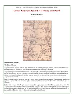
Grisly Assyrian Record of Torture and Death - faculty.uml.edu
faculty.uml.eduIsrael, besieged its capital at Samaria and, after three years of fighting, destroyed it ( 2 Kings 18:10 ). This probably occurred in the last year of Shalmaneser V’s reign (722 B.C.). However, his successor, Sargon II, later claimed credit for the victory. In any event, this defeat ended the national identity of the northern kingdom of
Related documents
Global Positioning Systems and Geographic …
extension.missouri.eduGeographic Information Systems ... Constructing a Geographic Information System for Biosecurity ... GIS information and maps have a
Cost-Benefit Analysis for Geographic Information …
gis.ny.govCost-Benefit Analysis for Geographic Information System ... A Geographic Information ... and displays information based on geography. GIS systems …

Applications of Geographic Information Systems
www.eolss.netSAMPLE CHAPTERS ENVIRONMENTAL MONITORING – Vol. II - Applications of Geographic Information Systems - Ondieki C.M. and Murimi S.K. Applications of Geographic Information
The use of Geographic Information Systems (GIS) …
psrcentre.organd environmental management, such as Ground Water Systems, Inc. (Mennecke, 2000). B. Facilities management . GIS have been used extensively for facilities management

BRIEF HISTORY OF GEOGRAPHICAL …
web.mst.eduIan McHarg (1920-2001) is credited with being the father of map overlays, which had a major impact on Geographical Information Systems He was a …
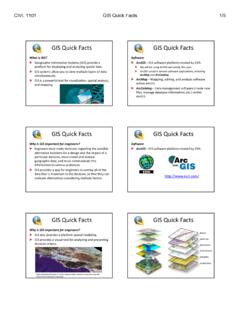
GIS quick facts - University of Memphis
www.ce.memphis.eduGIS Quick Facts What is GIS? Geographic Information Systems (GIS) provide a platform for displaying and analyzing spatial data.

Place Matters in the Helping Professions: GIS for …
www.esri.comPlace Matters in the Helping Professions: GIS for Human and Social Services Organizations . ... describes how geographic information systems ...
Geographical Information Systems (GIS) Concept …
www.caloes.ca.govGeographical Information Systems (GIS) Concept of Operations May 2017 ... GIS Geographic Information Systems ArcGIS Esri Software AGOL ArcGIS Online
Geographic Information Systems (GIS) - Advanced …
www.broward.eduCollege Catalog 2017-2018 www.broward.edu Geographic Information Systems (GIS) - Advanced Technical Certificate (4277) Career Pathway: Science, Technology, Engineering, and Math (STEM)
Geographic Information Systems for …
onlinepubs.trb.orgSpatial Data and Information Science 3 the middle of the next decade, interoperable logistics and dispatch systems will be standard throughout the …
Related search queries
Systems, Geographic, Geographic Information Systems, Geographic Information, GIS information, Benefit Analysis for Geographic Information, Benefit Analysis for Geographic Information System, Information, Applications of Geographic Information Systems, Use of Geographic Information Systems (GIS), BRIEF HISTORY OF GEOGRAPHICAL, Information Systems, GIS Quick Facts, Matters in the Helping Professions, Human and Social Services Organizations, Geographical Information Systems (GIS) Concept, Geographic Information Systems (GIS) - Advanced, Geographic Information Systems for