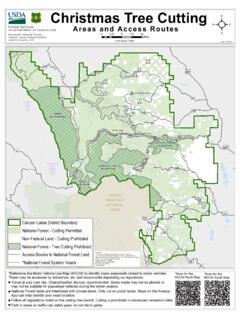
Christmas Tree Cutting ²
Canyon Lakes Ranger District Larimer County, CO Christmas Tree Cutting Areas and Access Routes D iscla mer: This map is fo r dis play purposes only and not for navig ation. T h eF ors tS v icg ,up dm fy repla cGIS od u ts w ih nf. F m : Arapaho and Roosevelt Natio nal Forests P aw ne N tio lGr s d, 2150 Centre Avenue, Building E, Ft. Co lins, O ...
Download Christmas Tree Cutting ²

Information
Domain:
Source:
Link to this page:
Documents from same domain
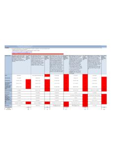
Average Annual Cost for Road Maintenance by Operational ...
www.fs.usda.govpatching, crack sealing, chip sealing and removal of unsuitable material. Shoulders are shaped to provide a smooth transition to traveled way and drain efficiently. Ditches and culverts function efficiently. Clean/Repair structures (cattleguard, gate) and signs. Paint pavement markings. Road
CAD Standards User’s Guide - USDA
www.fs.usda.govComputer Aided Design (CAD) construction and design drawings for the Forest Service. The purpose of this document is to establish standards, which will result in the preparation of consistent and compatible AutoCAD files. It is intended to guide users in the overall CAD system, operations, and to establish standards and procedures that will
Engineering Calculations DEMOLITION DEBRIS WASTE …
www.fs.usda.govstructures. To estimate the volume of the spread footing foundation, use the surface area method. For volume estimating purposes, assume that the slab is 12 in thick. There are 15 visible courses of 8-in tall concrete masonry units (CMU) serving as the Upper Level foundation; for volume estimating purposes assume the CMU foundation
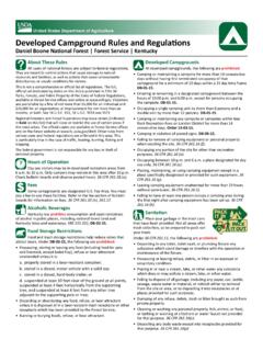
Developed Campground Rules and Regulations
www.fs.usda.govDay use visitors may be in developed recreation areas from 6 a.m. to 10 p.m. Only campers may remain in this area after 10 p.m. Check bulletin boards and observe posted hours. 36 CFR 261.58 (u). Fees Some campgrounds are designated U.S. Fee Area. You must pay a fee to use these facilities. Refer to the fee section of bulletin
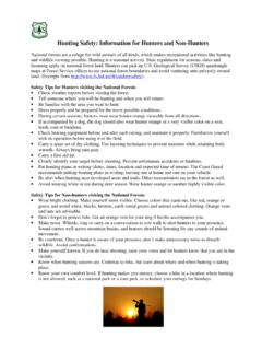
Hunting Safety: Information for Hunters and Non-Hunters
www.fs.usda.govSafety Tips for Non-hunters visiting the National Forests • Wear bright clothing. Make yourself more visible. Choose colors that stand out, like red, orange or green, and avoid white, blacks, browns, earth-toned greens and animal-colored clothing. Orange vests and hats are advisable. • Don’t forget to protect fido.
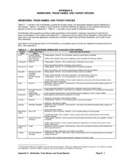
HERBICIDES, TRADE NAMES, AND TARGET SPECIES
www.fs.usda.govFor any pesticide classified as a potential carcinogen, the risk would depend on the extent to which a person might be exposed (how much time and to what quantity of the pesticide). The factors considered include short-term studies, long-term cancer studies, mutagenicity studies, and structure activity concerns.
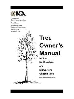
Tree Owner's Manual - USDA
www.fs.usda.govU.S. Department of Agriculture 11 Campus Blvd., Suite 200 Newtown Square, PA 19073 NA-FR-04-07 November 2008 www.na.fs.fed.us . Tree Owner's Manual . for the Northeastern and Midwestern United States . Tree Owner's Manual. Authors: Jill R. Johnson, Forest Service Gary R. Johnson, University of Minnesota Maureen H. McDonough, Michigan State ...
The Malheur National Forest - Home | US Forest Service
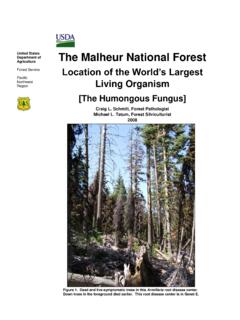
www.fs.usda.govForest Service Pacific Northwest Region The Malheur National Forest Location of the World’s Largest Living Organism [The Humongous Fungus] Craig L. Schmitt, Forest Pathologist Michael L. Tatum, Forest Silviculturist 2008 Figure 1. Dead and live-symptomatic trees in this Armillaria root disease center. Down trees in the foreground died earlier.
Snake Safety - US Forest Service
www.fs.usda.govStay calm Call Dispatch via radio or 911 Wash the bite area gently with soap and water if available Remove watches, rings, etc., which may constrict swelling
SPRAYER CALIBRATIONS AND CALCULATIONS
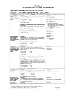
www.fs.usda.govV1 = 3 gallons The final mixture (Volume 2 or V2) is the amount of the concentrate (V1) plus the required amount to make up to V2. If V1 = 3 gallons and the required amount is 100 gallons, add 97 gallons of water to 3 gallons of concentrate. Formula 11 C1 x V1 = C2 x V2 C1= % of a.i. in concentrate V1 = quantity of concentrate needed
Related documents

AMTRAK SYSTEM TIMETABLE
www.timetables.orgJan 11, 2016 · ^ªl8 57P Dp b Grand Canyon, Phoenix— Ar ^ªl4 36A see page 85 %£^ª9 33P 1730 Williams Jct., AZ (Grand Can. Ry.) >w%£ %£^ª3 50A ^ª11 46P1873 Kingman, AZ (MST) >v ^ª1 33A b Laughlin, Las Vegas —see right 12 49A 1940 Needles, CA (PT) >w 12 23A 3 39A 2109 Barstow, CA >v 9 56P 4 18A 2146 Victorville, CA >w 9 10P 5 32A 2193 San Bernardino ...

Armls Grid Map - ARMLS® (Arizona Regional Multiple ...
armls.com$ˆ˙% $ ˚ ˘ ˜-ˆ 8 $ ˇˆ!! ˜" in maricopa ˇ˜ ˜ ˘:ˆ˜ % 5" ˙ ˚ ˝ 2!˜ ˇ ˘˜ ˙˚ ˜ ˜ $ ! ˇ
Map of Monitoring Areas - San
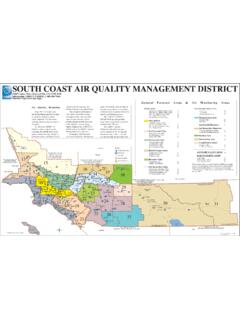
www.aqmd.govCanyon Irvine Laguna Niguel Mission Viejo Orange Cypress Indio Desert Pope Corona Norco Chino Hills Pomona Villa Park ... Grand Terrace Anaheim Yorba Linda La Palma Stanton Garden Westminster Grove Fountain Valley Yucca Valley Santa ... Anza Area 26 27 15 West San Bernardino Mountains Central San Bernardino Mountains 36 37 38 29
4th Grade Social Studies Practice Test
www.henry.k12.ga.usUse the map below to answer question 18. 18. Look at the map. What is located in grid square C-4? A. U.S. Capitol B. the White House C. Washington Monument D. National Air and Space Museum 19. Thomas Paine strongly believed that the American colonies should be independent of England. As a result, which of the following actions did he take? A.

to Reno
visitutahkenticostaging.blob.core.windows.netGrand Teton 300 miles to Denver 30 miles to Grand Junction 55 miles to Mesa Verde National Forest National Park State Park 225 miles to Boise 400 miles to Reno 12 miles to Great Basin 180 miles to Grand Canyon 110 miles to Las Vegas Four Corners Area FLAMING GORGE NTL. REC. AREA DINOSAUR NTL. MONUMENT ARCHES NATIONAL PARK CANYONLANDS …

White Pocket Brochure - BLM
www.blm.gov(800) 338-7888 Kane County Sheriff Kanab, UT (877) 644-2349 Glen Canyon NPS Dispatch Page, AZ ; or (800) 582-4351 (928) 608-6300 : BLM GSENM Visitor Center

Village Free Shuttle Buses Distances
www.nps.govGrand Canyon National Park: Located in northern Arizona, this World Heritage Site encompasses 277 miles (446 km) of the Colorado River and adjacent uplands. world, Grand Canyon offers visitors incomparable vistas. The : Pocket Map: is published by Grand Canyon National Park with support from your entrance fees. It is available in French, German,

Grand Canyon Area Map - National Park Service
www.nps.govCANYON N.R.A. RAINBOW BRIDGE N.M. NAVAJO N.M. VERMILION CLIFFS N.M. Lake Desert View pringdale Kanab a-PAIUTE VATION 389 Lake Powell Page 89T Four Corners CANYON DE CHELLY N.M. Ganado Window Rock ARIZONA 160 Kayenta NAVAJO INDIAN RESERVATION Chinle PIPE SPRING N.M. Road closed in Winter KAI BAR GRAND CANYON N.P. 169 Lake …